The unusual La Niña spring pattern continues…
The unusual La Niña spring pattern continues…
Monday we are wrapping up last night’s rain maker and transitioning into a “dirty ridge” which is another way of saying we could have/might see some nice wx for Tues/wed but will probably deal with some cloud deck. As a result it probably won’t make for much sunny warmth.
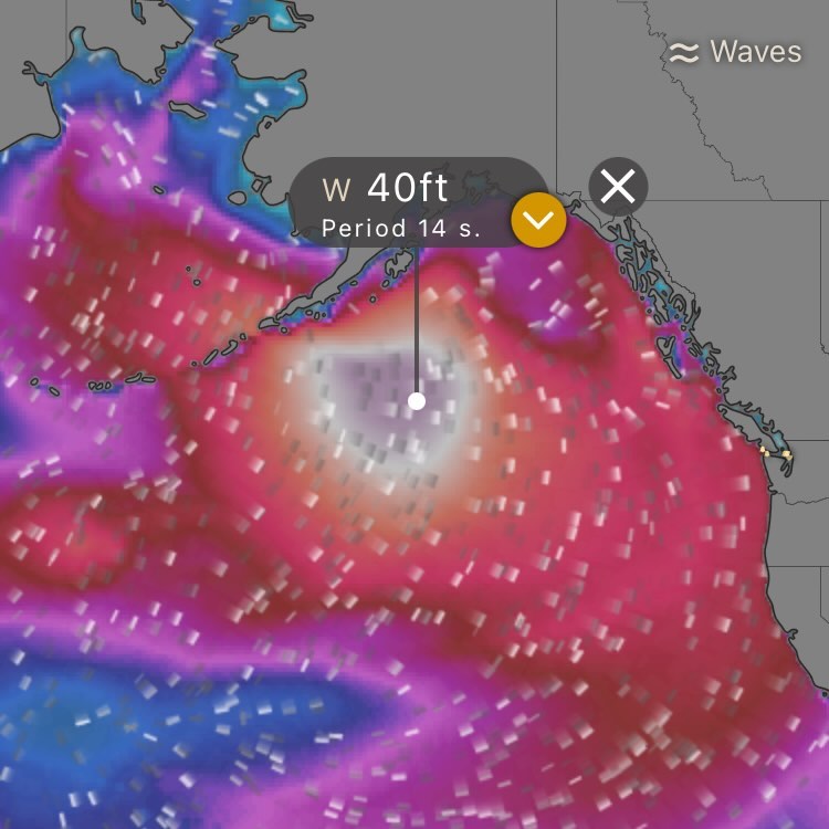
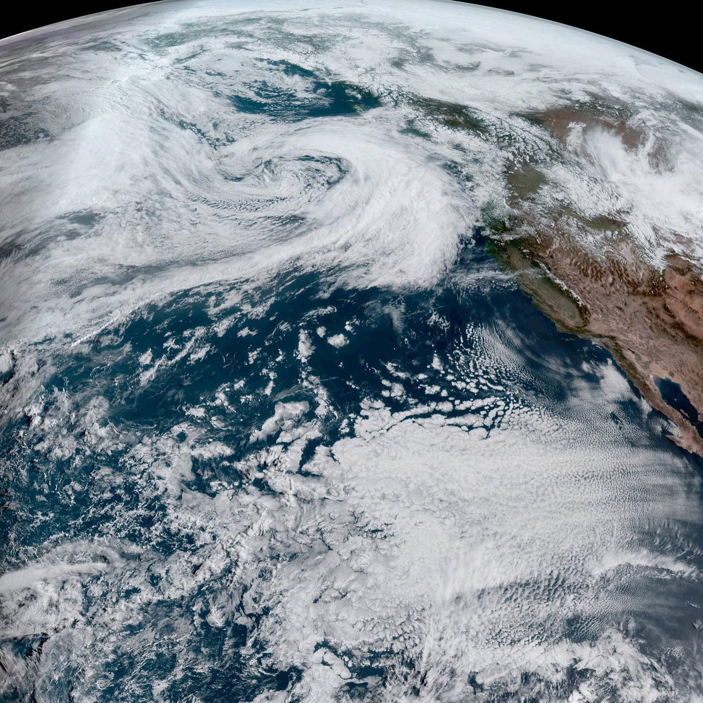
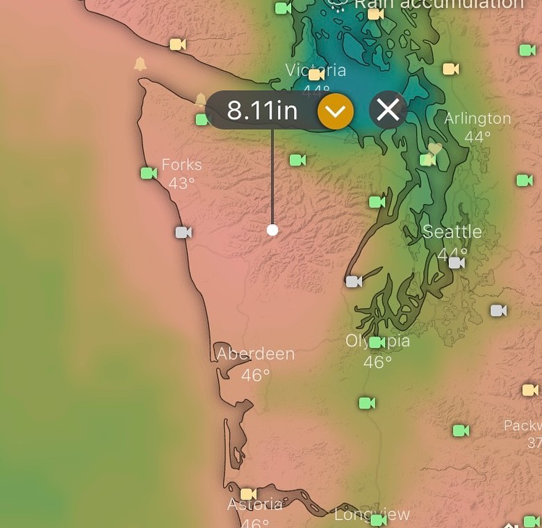
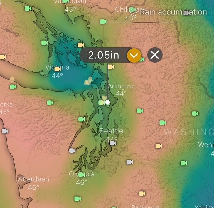
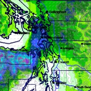
The next system makes itself known on Thursday and into the weekend when we’ll likely see rain and this system is packing some wind gradients (see image 2). Right now the extended forecast is sending the wind down into Oregon and southern WA, but a lot can change, and I wouldn’t rule out some intense wind happening here on the south end overnight Thursday and into Friday.
I’ll try and update before the next system approaches towards the end of the workweek.
Historically this scale of windstorm is very rare for May. La Niña keeping us on our toes. Amazing to be tracking this type of weather into May!
![Image [Accumulated Total Snowfall] With about a month of non-eventful weather and high pressure ridging over the PNW, finally have a reason to make a quick update on our #southWhidbey weather.](/assets/img/blog/2022-02-20-09-52-39.jpg)