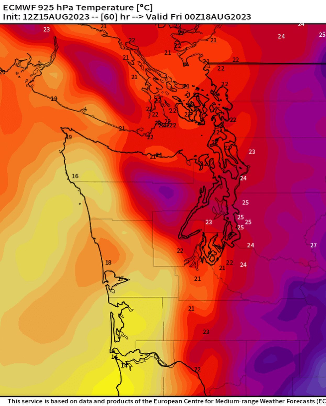
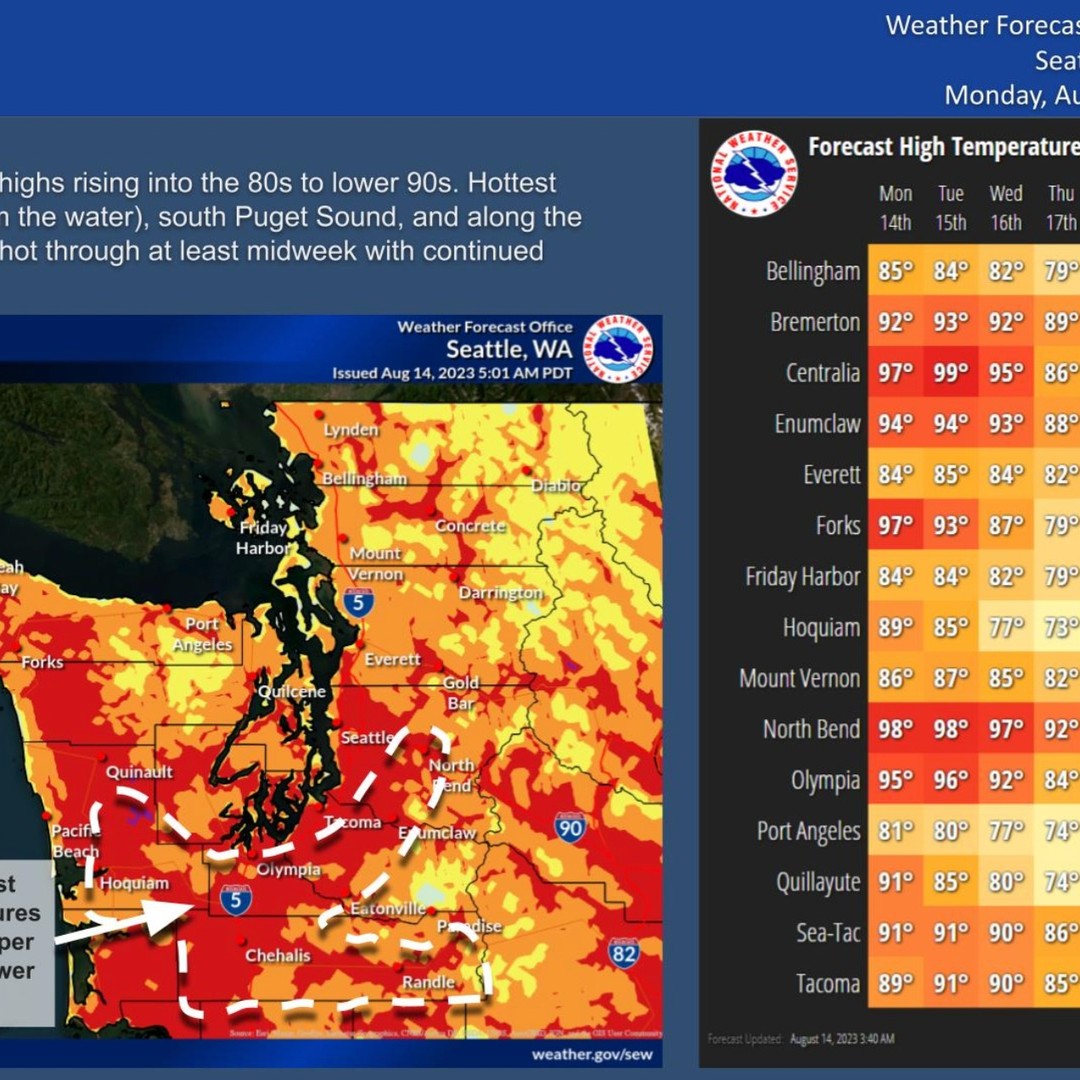
Real hot. Another spicy day tomorrow for us before we turn up the westerlies for more seasonable temps into Thursday and the weekend.
By Sunday we’re looking at rain chances with a high around 70.
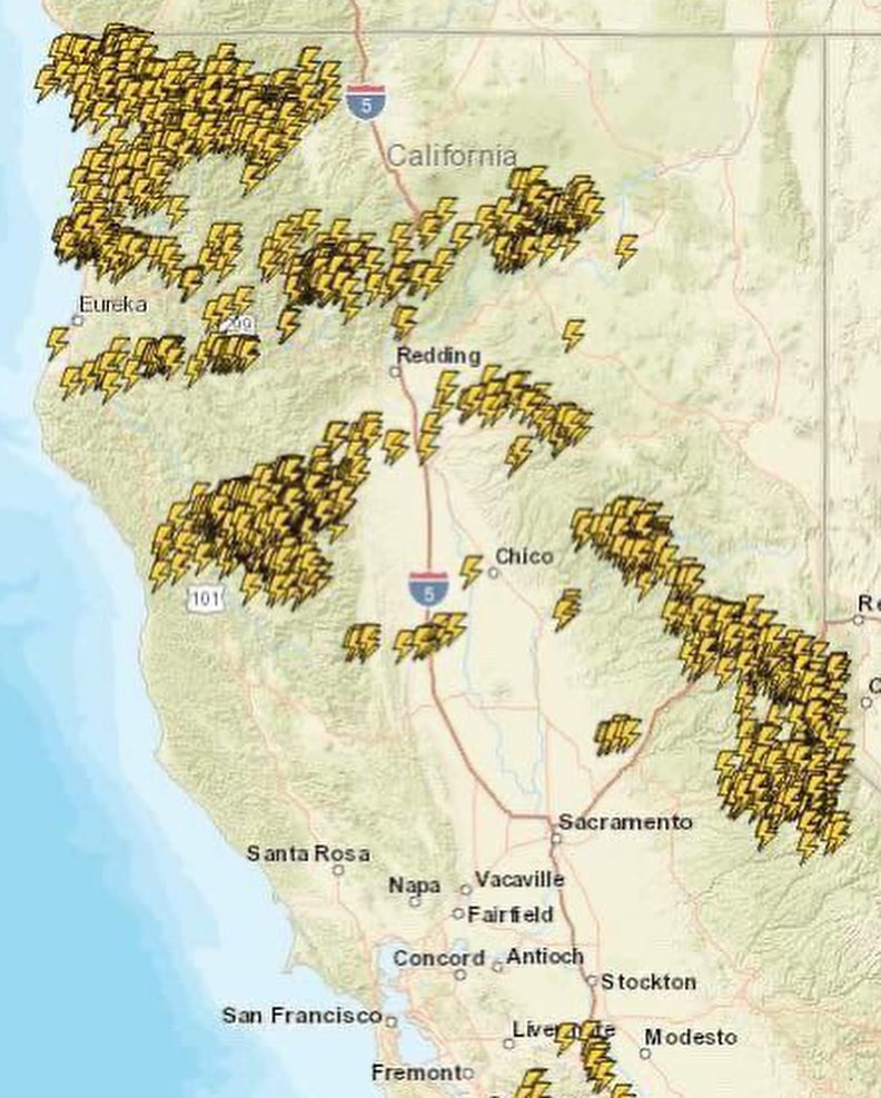
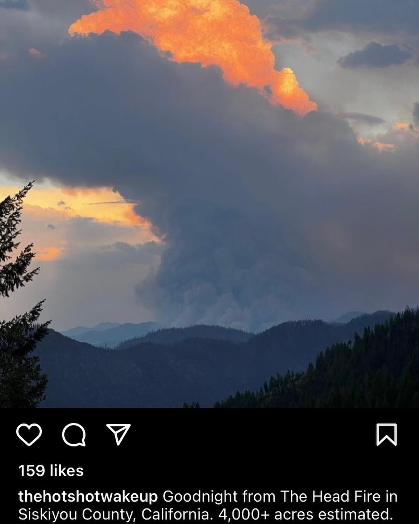
Northern California today (Tuesday) was getting absolutely hammered by lightning with over 3200 recorded lightning strikes today alone. As a result, multiple new fires have kicked off around northern CA. If you have family, friends, or interests down there heads up.
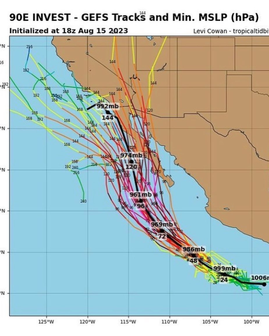
Lastly I’m having fun tracking a real rarity of a weather event with the long range models throwing a tropical storm into Southern California??
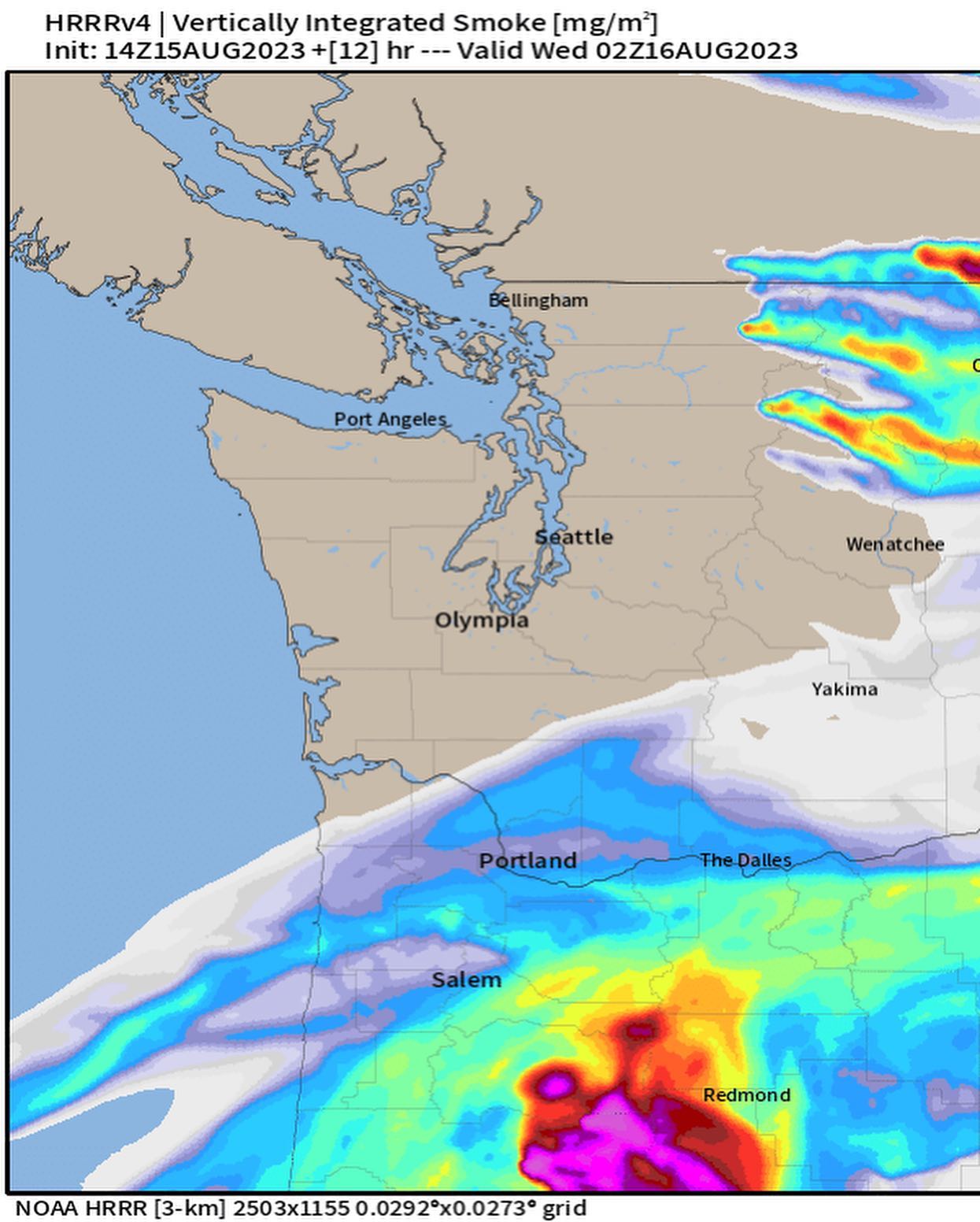
Hold on to your butts over the next (3) days. If the Cascades can stay fire-free over the next few days we might just make it out of this heat event without a significant impact to our AQI and further strain to wild land firefighters.
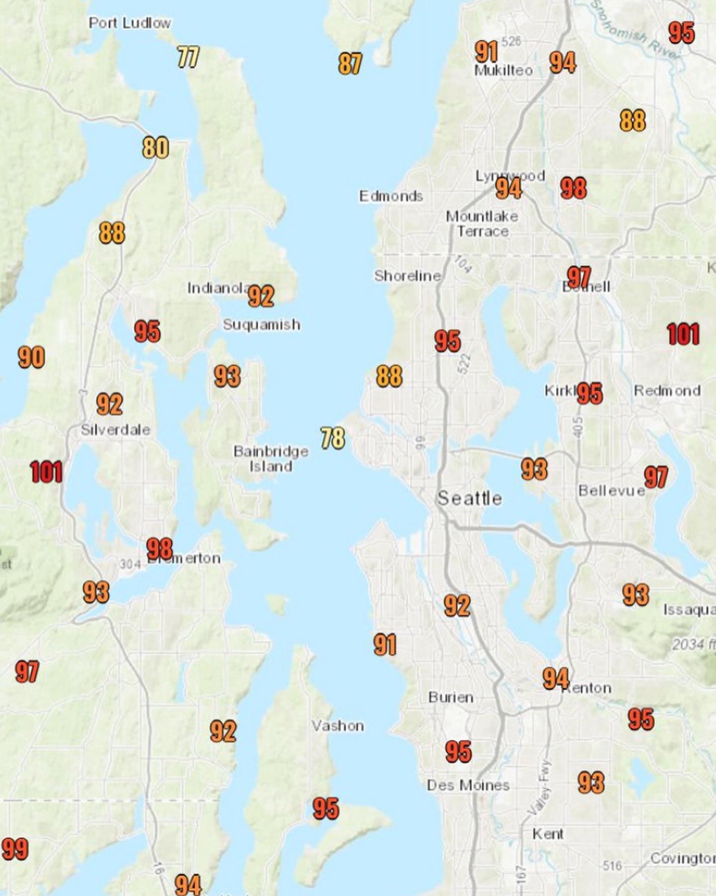
Oregon, as you can see, is feeling the brunt of this event. Portland hit 100 yesterday, along with Salem. Containment is moving up on the fires in Oregon, but the next couple days are going to be a tough fight.
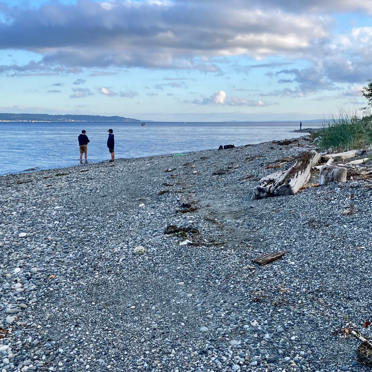
Locally, our air conditioning unit (the strait) is currently working in the afternoon, giving us some sea breezes and relief. Let’s hope those continue, as these are going to be the hottest days of the year.
About that heat… we’re finally close enough to the previously mentioned heat signal to deduce some reliable data from the models.
Sunday afternoon we transition to a warmer, drier period.
Not thinking this is a record breaker by any means, and we may even see some relief with sea breeze. If anyone remembers the infamous “heat dome” of 2021 — this isn’t that.
Monday morning I’m seeing some light offshore flow which might bring some smoke?
Upper atmosphere smoke can also cool the high temps, so we’ll need to check the HRRR Smoke in 36h for the update.
Friday evening update - A lot of interesting weather over the coming weeks.
First off, note the monsoon moisture / t-storms lurking from east to west in the first slide.
We’ll feel a noticeable change in weather this weekend as we see a potential spillover of monsoonal flow creeping from south to north tomorrow (Saturday).
Can’t rule out some showers, and if we do get a break in the monsoon clouds Sunday, the Sunday evening atmosphere has a chance to bloom with instability.
Could we get lightning in the lowlands? Maybe. Probably not – but the Cascade and Olympic ranges are due for thunderstorms this weekend.
Heads up if you’re heading into the backcountry we may be dealing with dry lightning in the mountains (and possibly fires up in the high country too).
If you’re headed to Seattle for Seafair things may also get interesting (both Sat and Sun) with pilots having to deal with lower cloud decks both Sat and Sun.
In the extended, things are looking spicy.
The end of the second slide is showing a classic thermal ridge signature. Very pronounced.
It’s still off in the 10-day, so things can change, but we’re looking at a fairly strong signal (over multiple runs) for a heat wave from about August 14th into mid-month.
This one will likely see us tapping the low 90s, but there’s still a lot to re-evaluate over the next few days on that. Stay tuned.
Additionally we may be seeing a change in AQI as the weekend turns winds offshore, hopefully we’re not seeing a rash of dry lightning strikes over the weekend in the mountains, but I’m expecting we get a few fires this weekend from lightning strikes around the cascades.
Will update us on the thermal trough / heatwave as the data becomes available.
In the meantime, next week looks like we may have another shot at rain. Nothing dramatic, but we might get some residual moisture moving through before the heatwave drops. Consider capturing some rain for the following week!
Zonal flow with good AQI and millions of salmon making their way back into watersheds around the Salish, monsoon moisture dominating the great basin.
Firefighters have been making solid progress on the Oregon fires previously mentioned in recent posts.
Not much to mention here outside of pleasant, moderate weather for the extended outlook.
So far we’re getting lucky with generally mild temps, afternoon sea breezes, and clean air with good visibility.
In yesterday’s loop, you’ll see some fires off the rockies of Montana, with a large fire effecting the Okanagen literally on the border. (Not effecting us).
Will keep us posted if anything jumps out, in the meantime, enjoy the seasonable vibes out there…
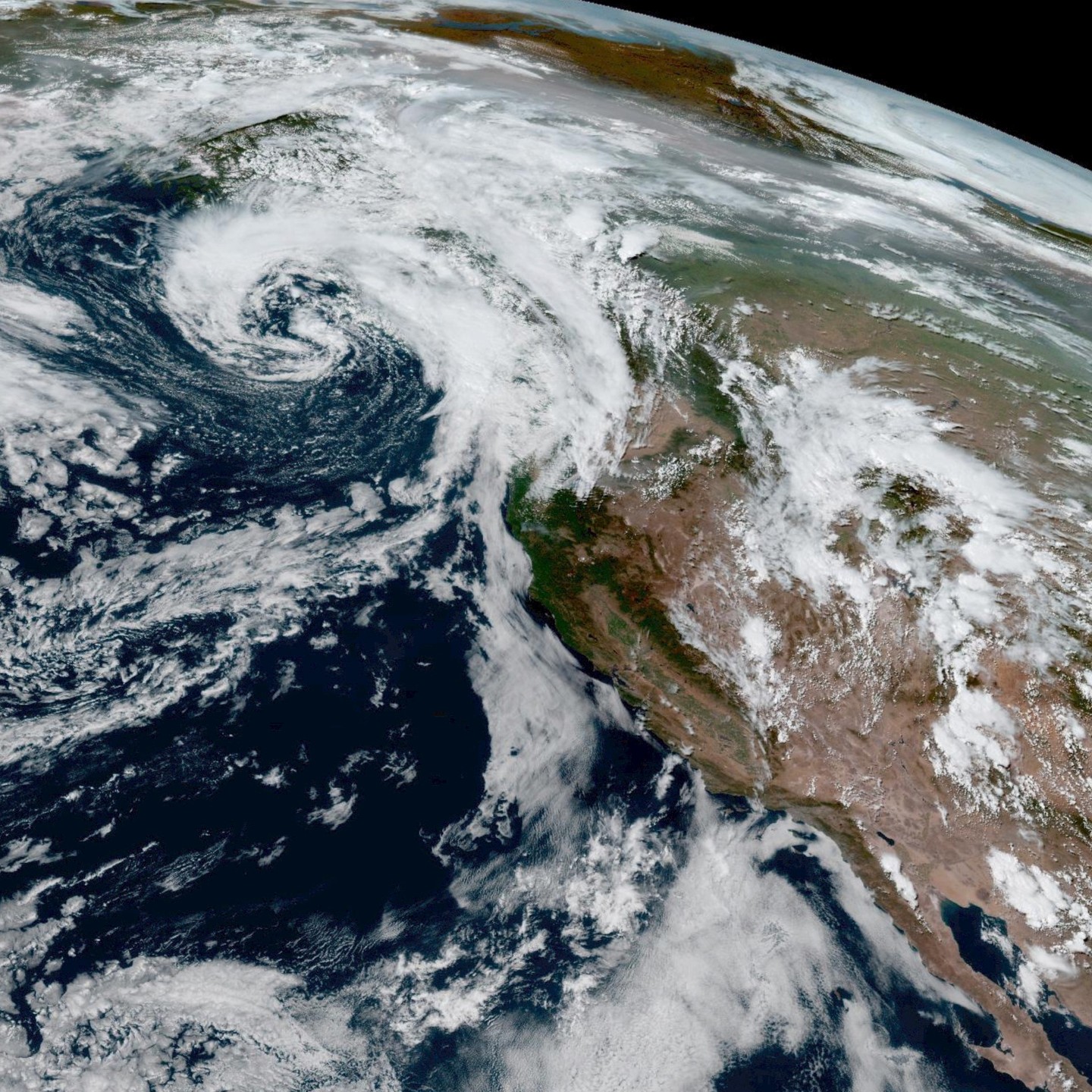
Are you stoked? I’m stoked! Rain during this part of July is a real rarity. Mother nature’s air conditioning is looking like it’s going to turn on the next couple days.
Did you know that our region receives less precipitation than the desert southwest this time of year?
This system (pictured) is taking it’s time getting to us today (Sunday PM), as otherwise you’d have no reason to believe it would actually rain in the next couple days.
BUT – once the clouds overtake us, we may be in for 0.25” inches of rain or so? Probably less? It’s summer so I don’t trust the models too much as rain in mid-July doesn’t have much precedence.
Still fun to get some possible rain and a couple cool mornings Monday and Tuesday this week.
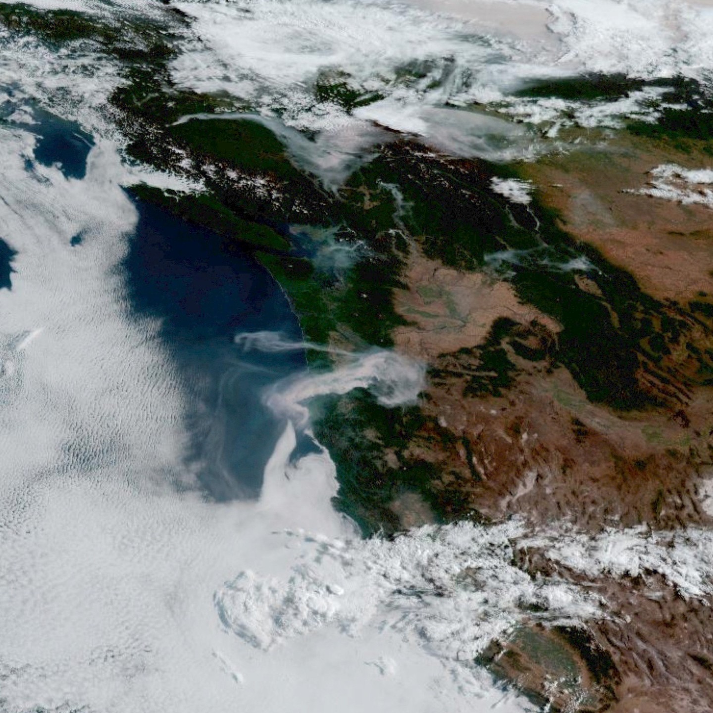
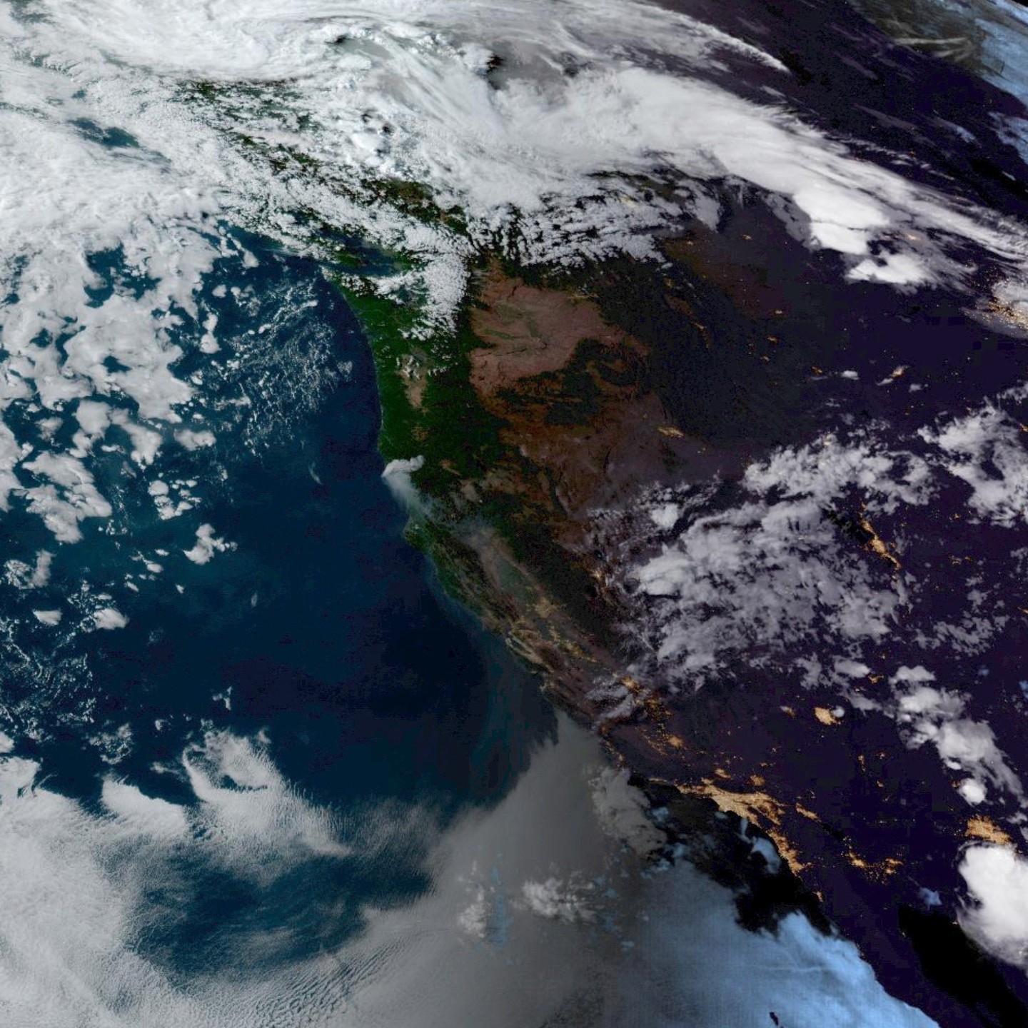
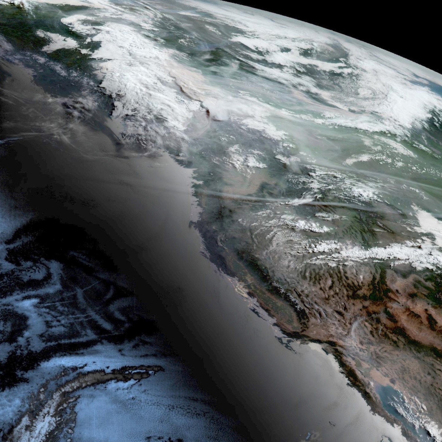
This morning’s view. A beautiful day for us today, but I can’t help but notice what’s going on with our next door neighbor. Unprecedented smoke 💨 happening in BC and Alberta.
It’s never my intention to cause panic, anxiety, or fear on this account. I really just try and help our community prepare for weather related events.
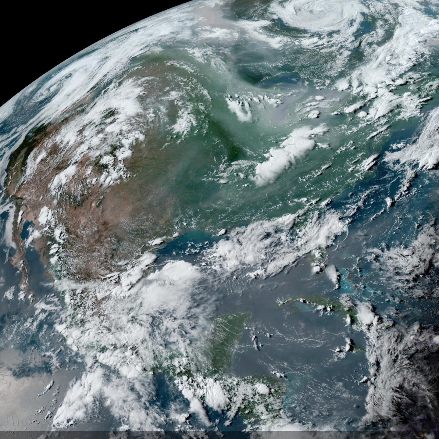
One thing I like to do regularly is check the live satellite (GOES) feed (pictured). Yesterday’s fire activity in British Columbia was incredible. (You can see the thunderstorm vs smoke in the video)
These fires are separate from the ones mentioned in my last post. They’re occurring closer on the east slopes of the coast range, with additional fires in the interior also burning.
Not expecting this smoke to effect us in the short term, but I have a hunch that what we’re seeing up north may be an indicator of our late summer here in the pnw.
Don’t hesitate to scoop up a box of N95s or an extra air filter for the house before everyone is making a rush for them.
It’s not if, it’s when (my opinion) the smoke is coming.
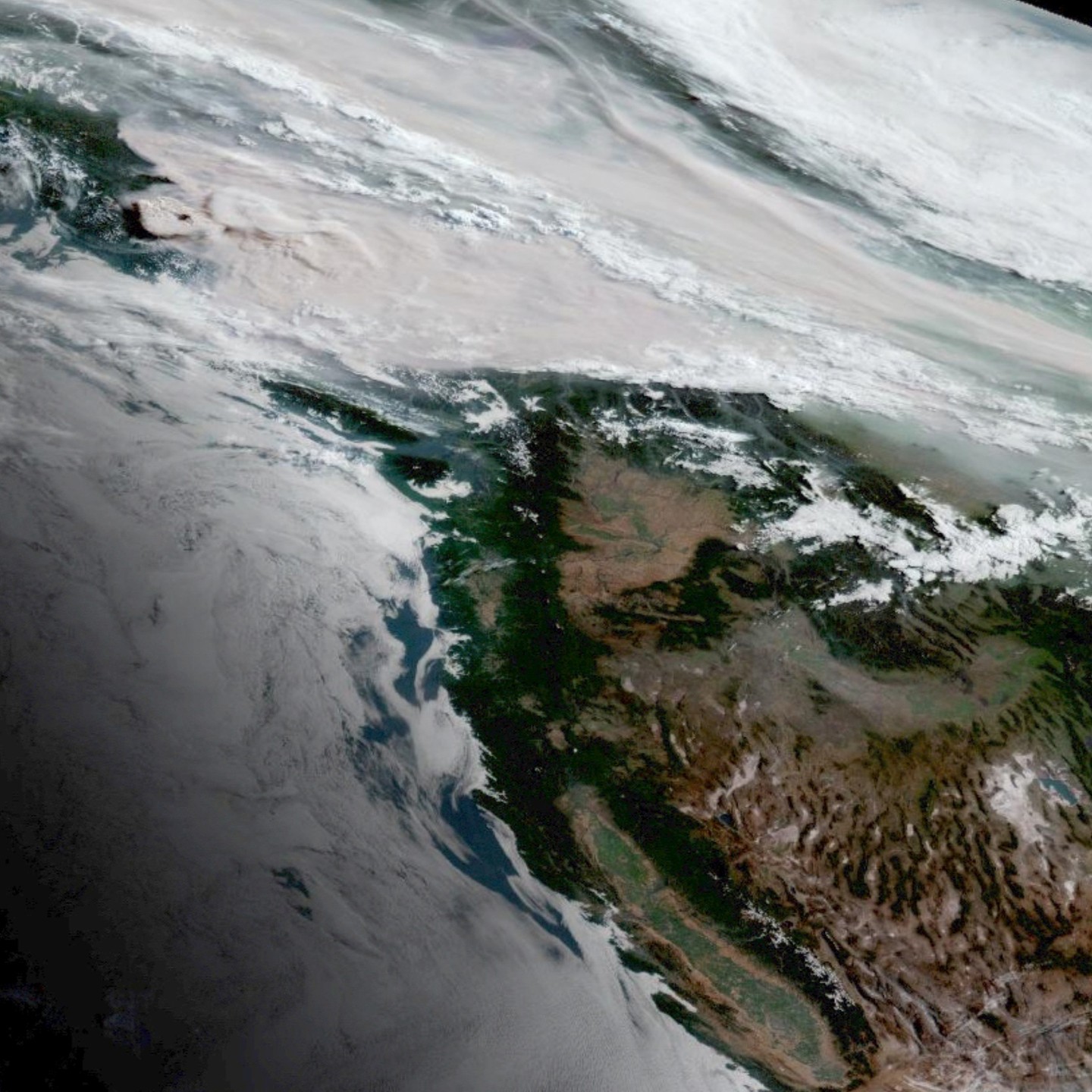
Waking up to a fair bit of smoke in the upper atmosphere this morning.
Majority of this smoke is originating from the fires burning near the Kaska Dena First Nation of the ross river area of northern BC.
In the first image you’ll see the fire activity pushing into the bottom layer of the tropopause, which is a significant increase from the past few days.
These fires are burning in previously clearcut old growth forests, on 2nd and 3rd growth on the southern arctic tundra. These habitats can be acutely problematic in wildfire situations compared to old growth which can survive and actually benefit from wildfire (in many cases).
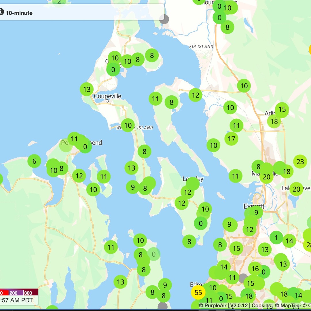
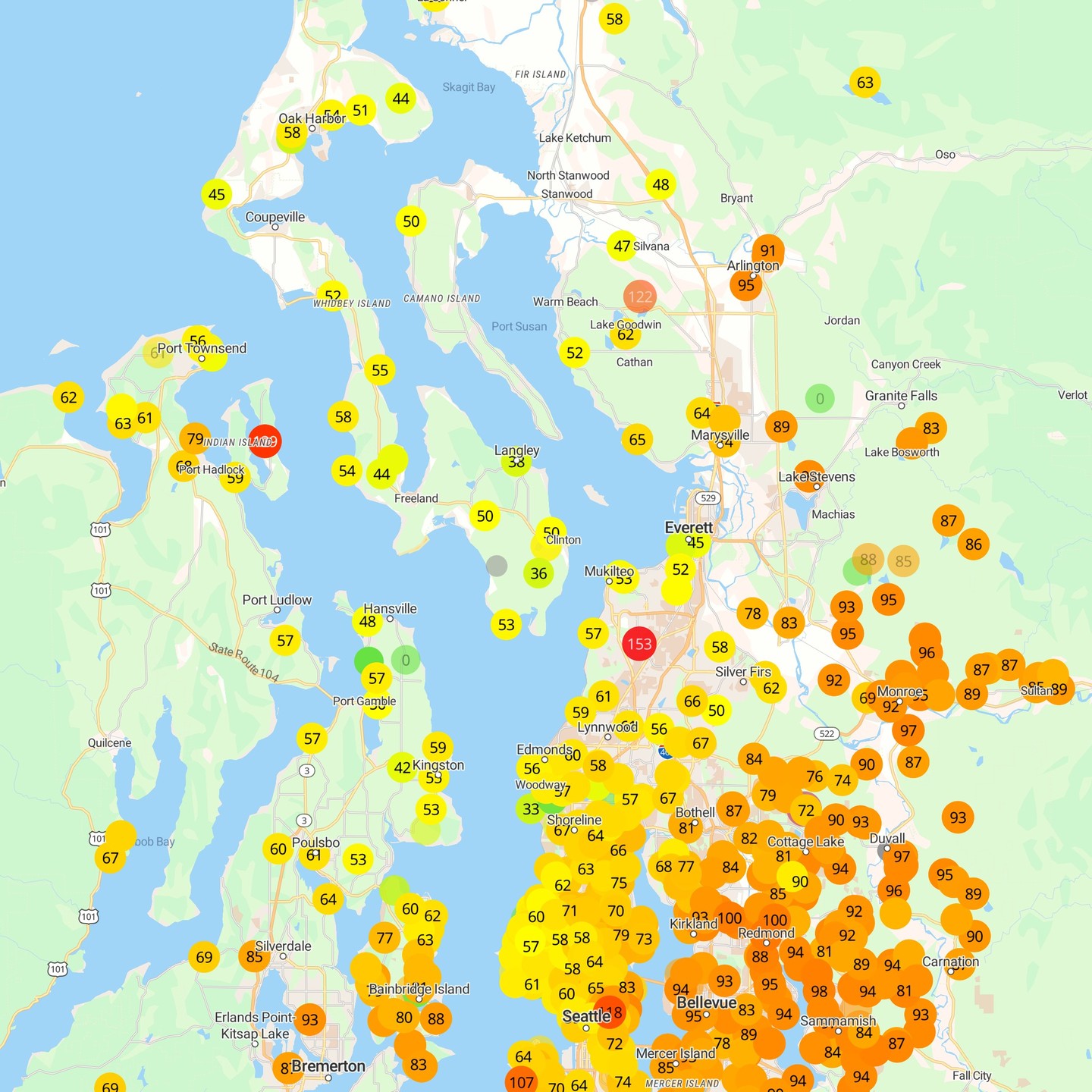
Second slide is our current AQI here on the island, which is quite low (lower = healthy), even compared to the mainland, so the smoke is generally staying in the upper atmosphere for now, thankfully. (Would be nice to have a few more sensors on the island!)
Previously mentioned heatwave is upon us, with afternoon temps pushing into the upper 80s, we are seeing some west wind pushing down the strait in the afternoons, which will cool us slightly and provide decent mixing, mostly keeping smoke confined to the upper atmosphere.
Temps will be hot and dry this week! July 5th we peak on temps and plateau into the following weekend. Nothing like the heat dome of 2021, but the heat will be quite sustained, so stay chill and plan your outside work early or take advantage of the fullest full moon of the year (so far) and have yourself a proper mid day siesta and become a night owl/werewolf. Air quality has been *chefs kiss* fingers crossed 🤞 it stays good