Steady rain tonight with a frontal passage overnight.
Steady rain tonight with a frontal passage overnight. Monday we start off showery and move into a week of mostly dry weather and seasonal temps.
Ridging looks to set in for the later half of the workweek keeping things calm and dry.
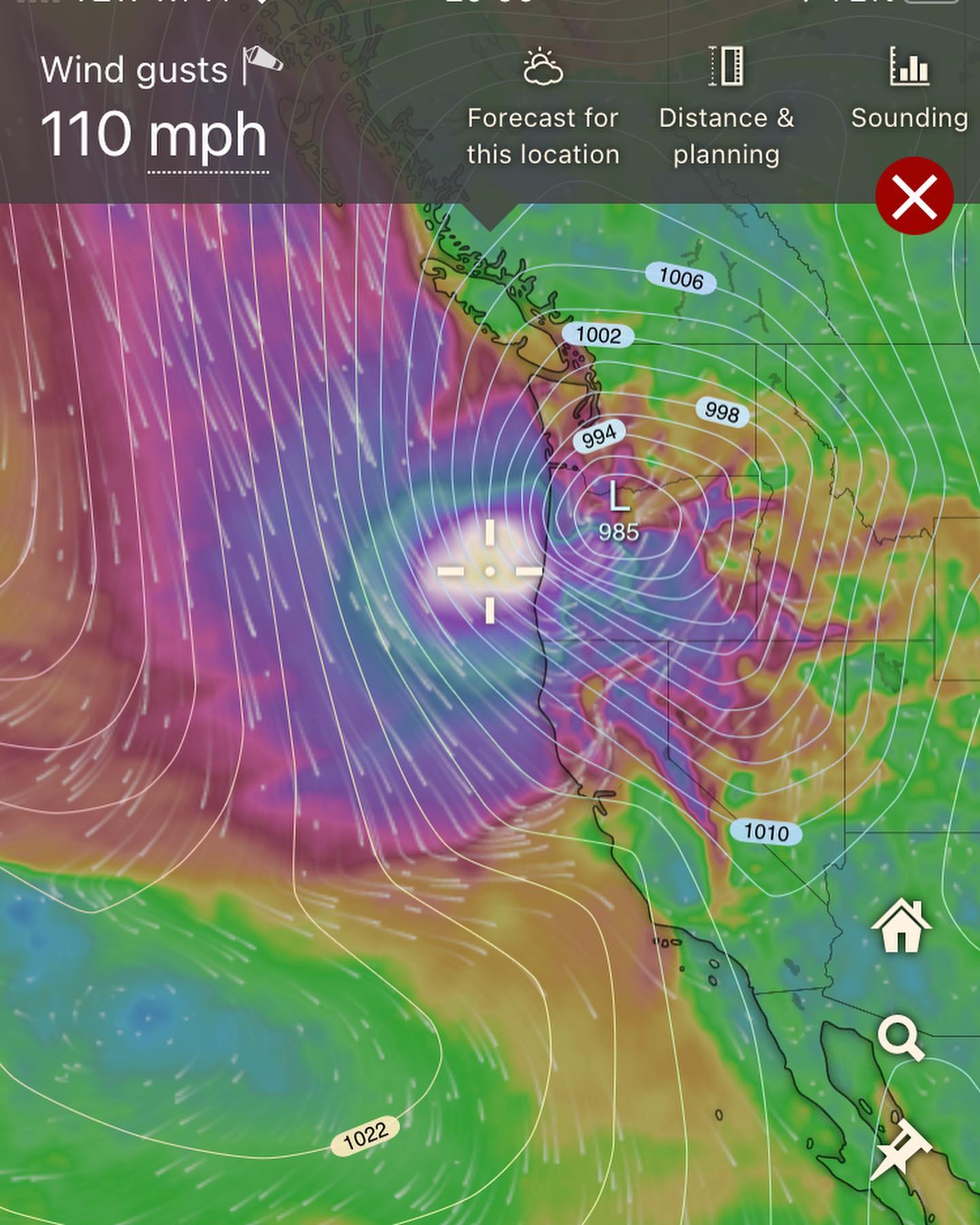
Previously mentioned windstorm on the extended is still showing up. Tonight the Euro has it driving into Astoria, OR and impacting Portland.
Timing is still looking like Monday Nov 20th, but if you check my last post, models were throwing this beast into Vancouver Island.
Since it’s so far out in the extended, and so much can change, we’re likely to see the location of this storm move anywhere from SE Alaska to northern CA on any given run.
Models remaining bullish on wind speeds, with tonight’s run pushing 110mph gusts into the Oregon coast.
Will update on that storm this week. Fun to watch that one. Wherever it ends up, it should be a memorable experience to say the least.
#wawx