Image 1: The previously mentioned storm has fully come to birth on the #GOES17 at 1500 on Jan.
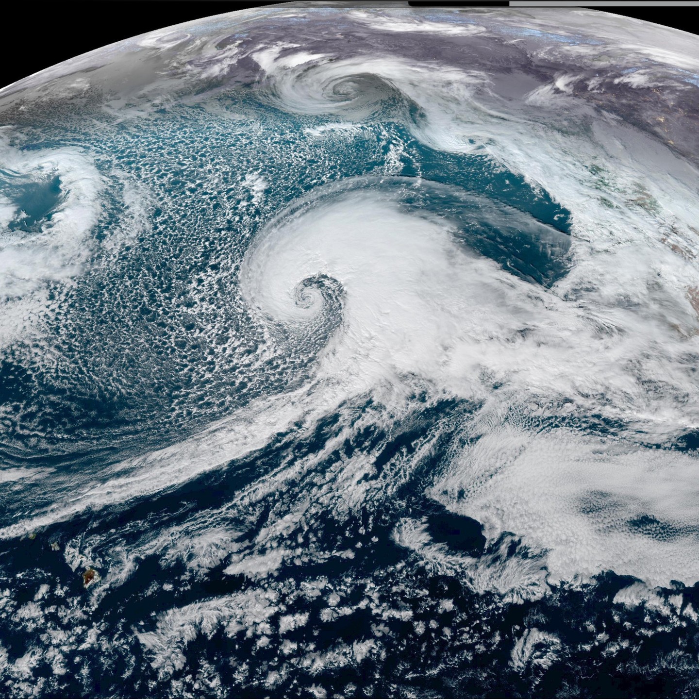
Image 1: The previously mentioned storm has fully come to birth on the #GOES17 at 1500 on Jan. 3rd, 2023. Just a remarkable system headed into Northern CA here. Big wave maker. Big snow maker. Hopefully this can make a dent in the west’s current drought numbers.
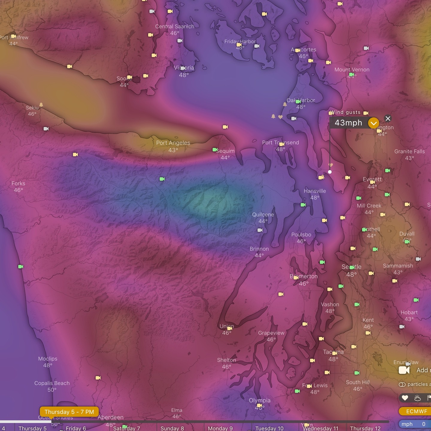
Image 2: Thursday evening wind estimates for the puget sound. Locally just a gorgeous day yesterday and today. Remarkable visibility! Mt. Baker, Glacier Peak, The Olympics, Tahoma all came out to say hello. Even caught a few #Lenticulars off the Sequim side of the Olympics too!
Wednesday and Thursday we revisit rain and wind potential.
I’m posting a quick heads up for a Thursday evening system. We have some time to track it, but we’re flirting with windstorm potential with gusts to 45mph on the European model. Still a ways to go, so nothing to be concerned about yet – just keeping an eye on it to see where the wind estimates are trending tomorrow.
I’ll update us on that incoming weather tomorrow AM when the fresh model runs are up.
#cawx #orwx #wawx