We’ve got a polar lobe setting up shop above 10,000ft with brutally low temperatures aloft.
Any radiational heating or sun breaks over the next few days will create plumes of warm air rising into this polar lobe.
Not a fun day for flying (unless you’re a fan of turbulence), but the cloud watching is pretty epic, and we might might even see some lightning flashes ⚡️ 🌧️
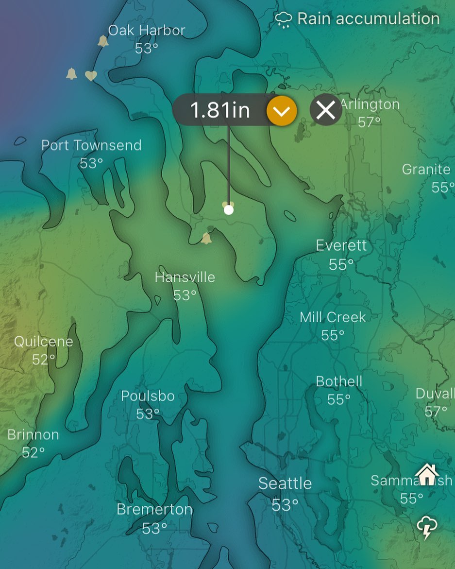
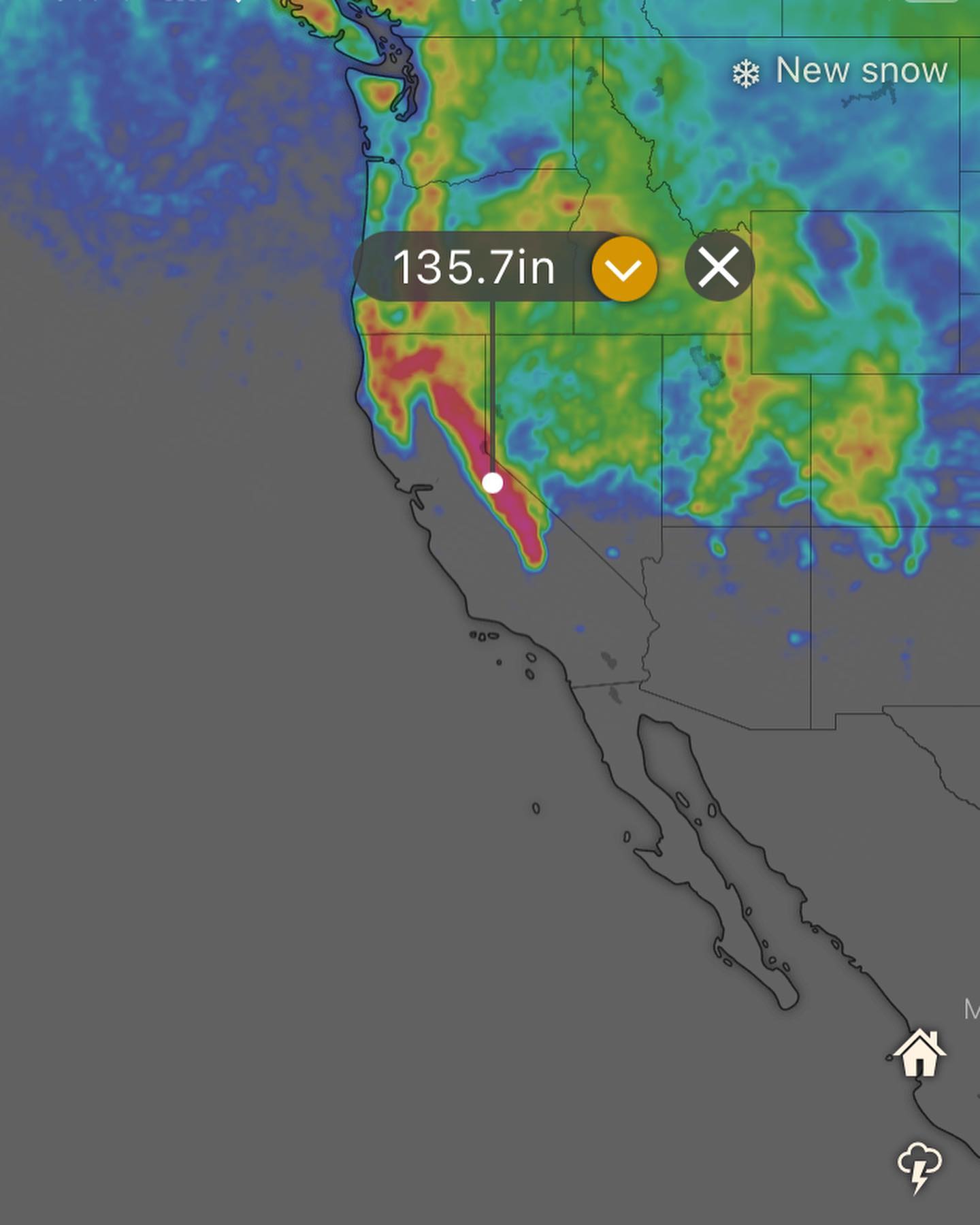
Fun seeing a good chance at rain this late in the season. Today (Tuesday) and tomorrow we cool down with a good surge of westerly winds down the strait in the afternoons, followed by Thursday and Friday being warm and sunny.
This weekend a late season trough digs down and parks it above us giving more chances of steady rain for Saturday, Sunday and into next week.
This would be a well needed shot of precip during an abnormally dry spring for us. This should help mitigate the fire threat effecting all of western Washington at the moment.
This system will also benefit the fires currently burning in BC and Alberta, which can have an impact on our air quality here on the island.
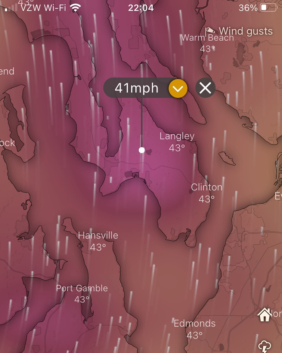
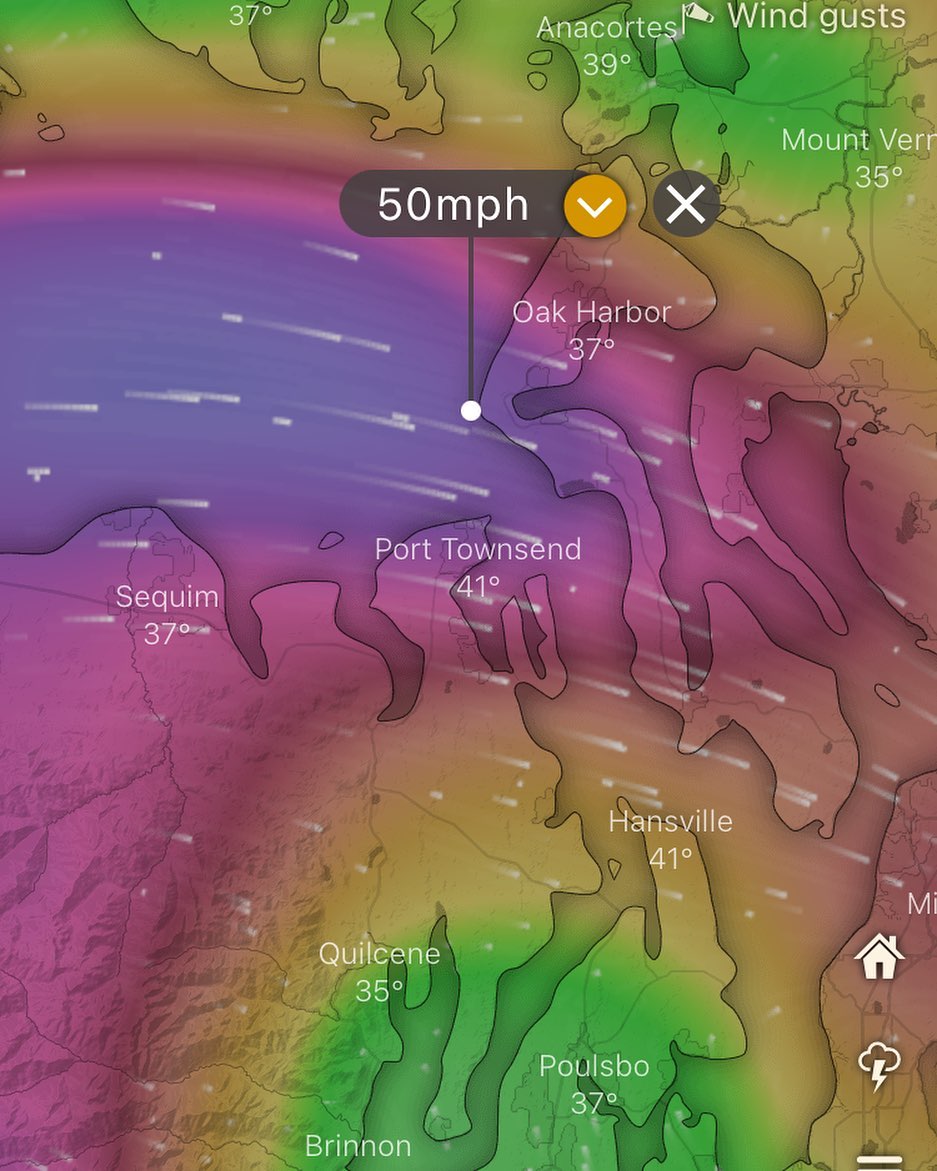
Update is looking good! Winds trending down to about 40MPH tomorrow - 40 is usually manageable here, 50 is borderline and 60 is pretty much guaranteed power outage so tomorrow is looking better on the latest hi-res forecasts..
This is likely the last La Niña spring for a while and this is the 3rd spring in a row in La Niña. El Niño is forecast to return (and is already returning) this summer.
Workweek looking grey with temps around the low 40s. Pray for sun breaks!
Going to take a look at CAPE and update again, but I’m reminded of previous La Niña April systems that gave us remarkable lightning shows and hail — we can get some freak cells on these spring pacific systems!
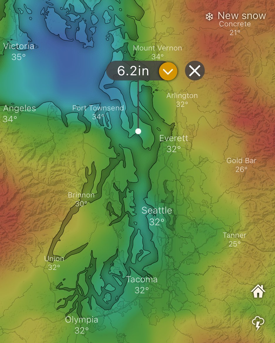
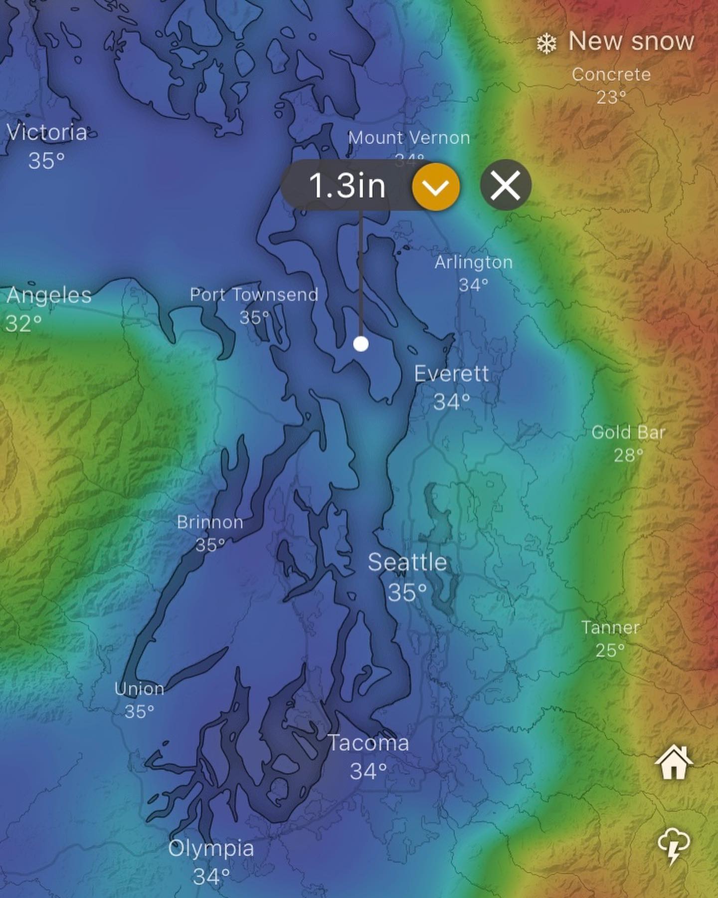
Half a foot of snow expected over the next 10days… euro and gfs models paint us into a “snow shadow” but from past experience that snow shadow hasn’t been accurate on the GFS or the Euro, so keep your mind open to the idea of accumulating snow into the first weeks of March.
Classic La Niña pnw spring in progress. The little boy has started in the equatorial pacific but that doesn’t translate into an El Niño spring.. some effects of ocean sea surface temps aren’t quick on the atmosphere, they permeate across months of time… so maybe our spring will be similar to last spring, but might not extend quite so far into early summer?
Video for context (from a previous storm) — update for Sunday night…
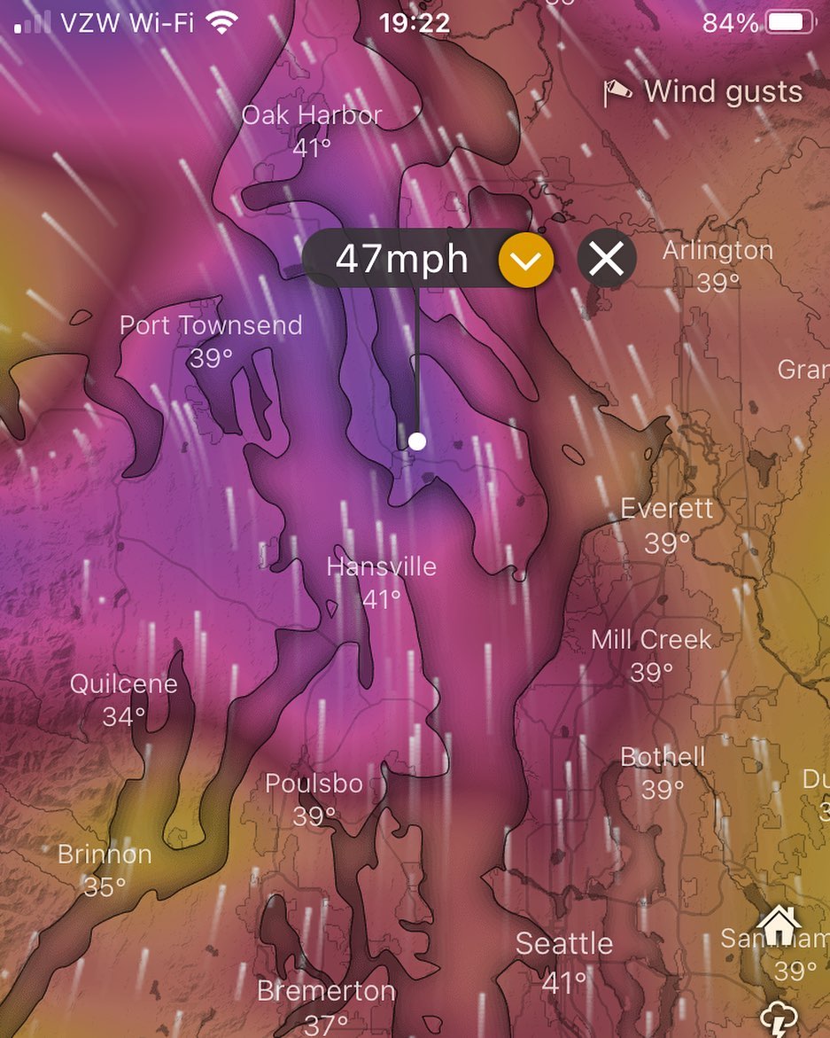
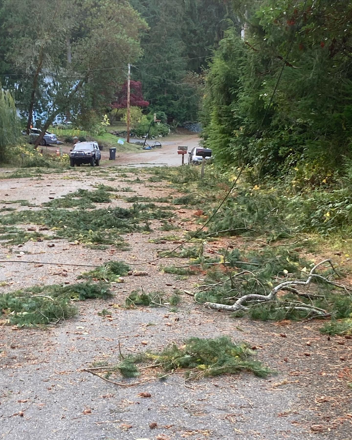
Monday/Tuesday windstorm has trended down in intensity on the models, but it’s still enough to knock down trees and generally cause the standard amount of mayhem we see regularly during these events. 🌊 🌬️ 🌊
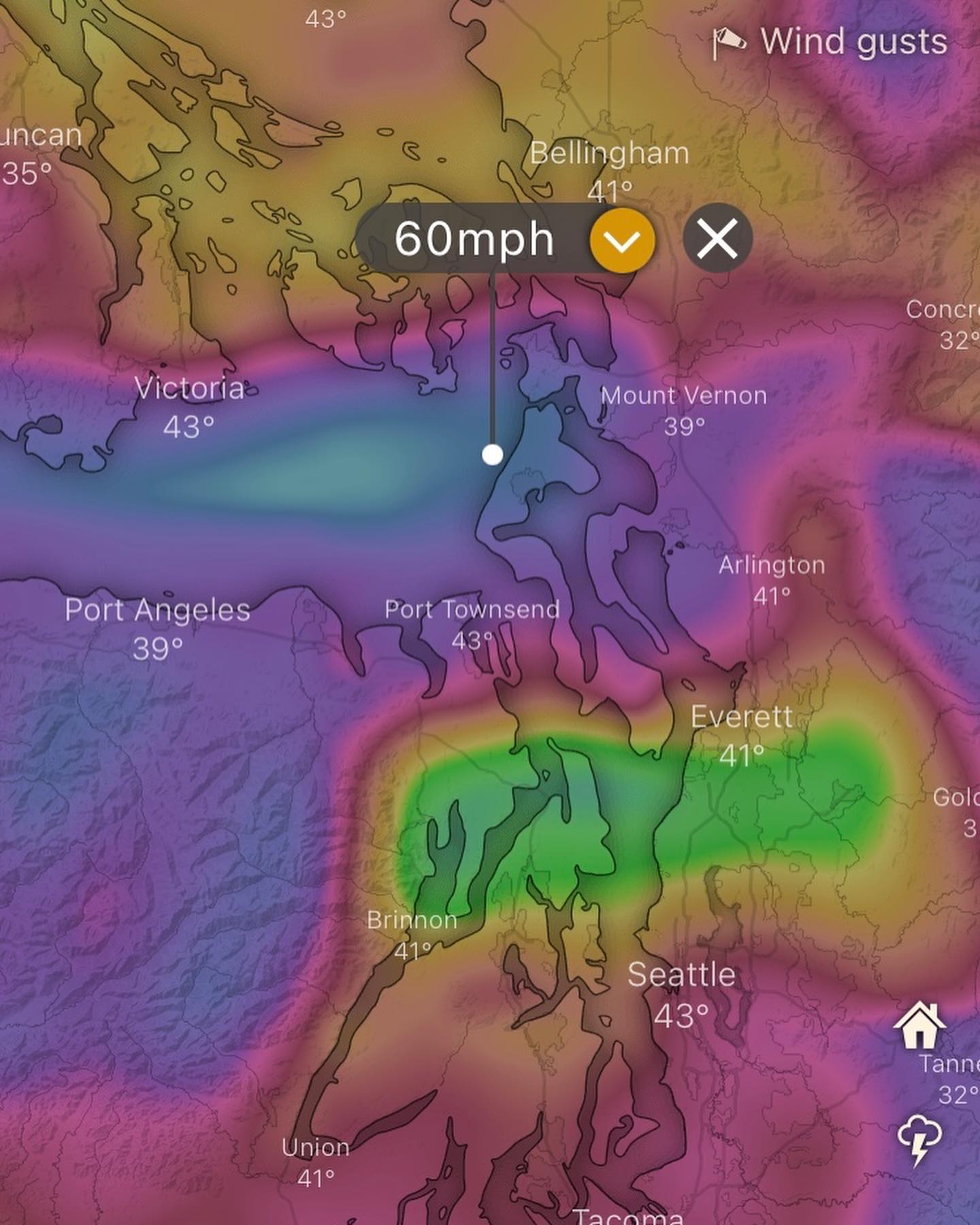
Tues/Wed there’s still a good chance the power could be out. But not 100% as we’re coming in around 55mph gusts. It’s a grey area really.
Winds are looking strong from midnight Monday into Tuesday morning. 🌬️ 🌲 ⚡️
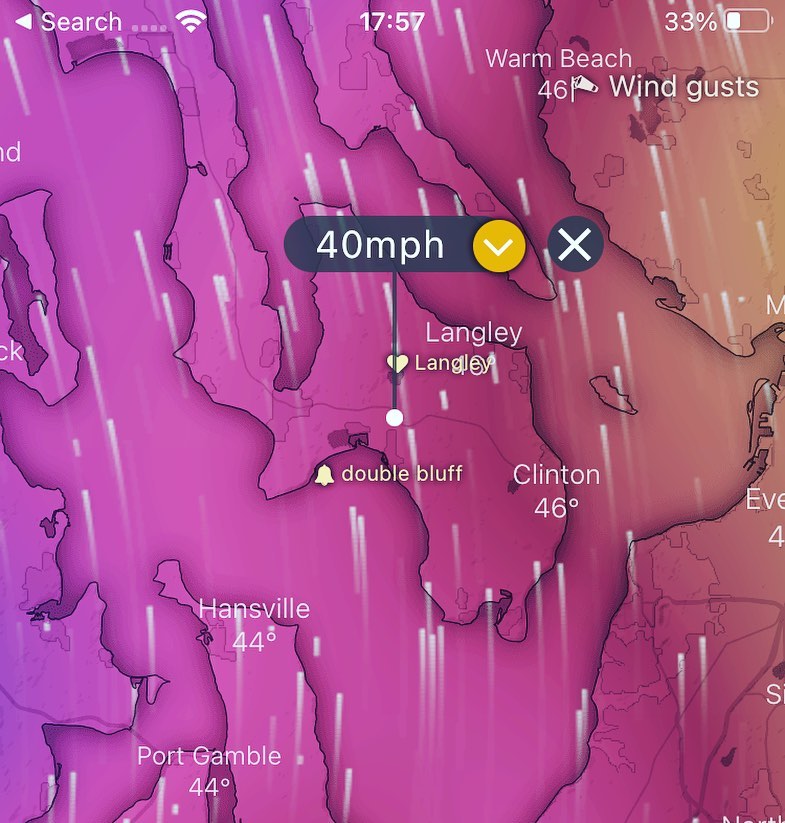
Winds start at 40MPH from the south and then shift to West / Nw around midnight gusting to 55mph.
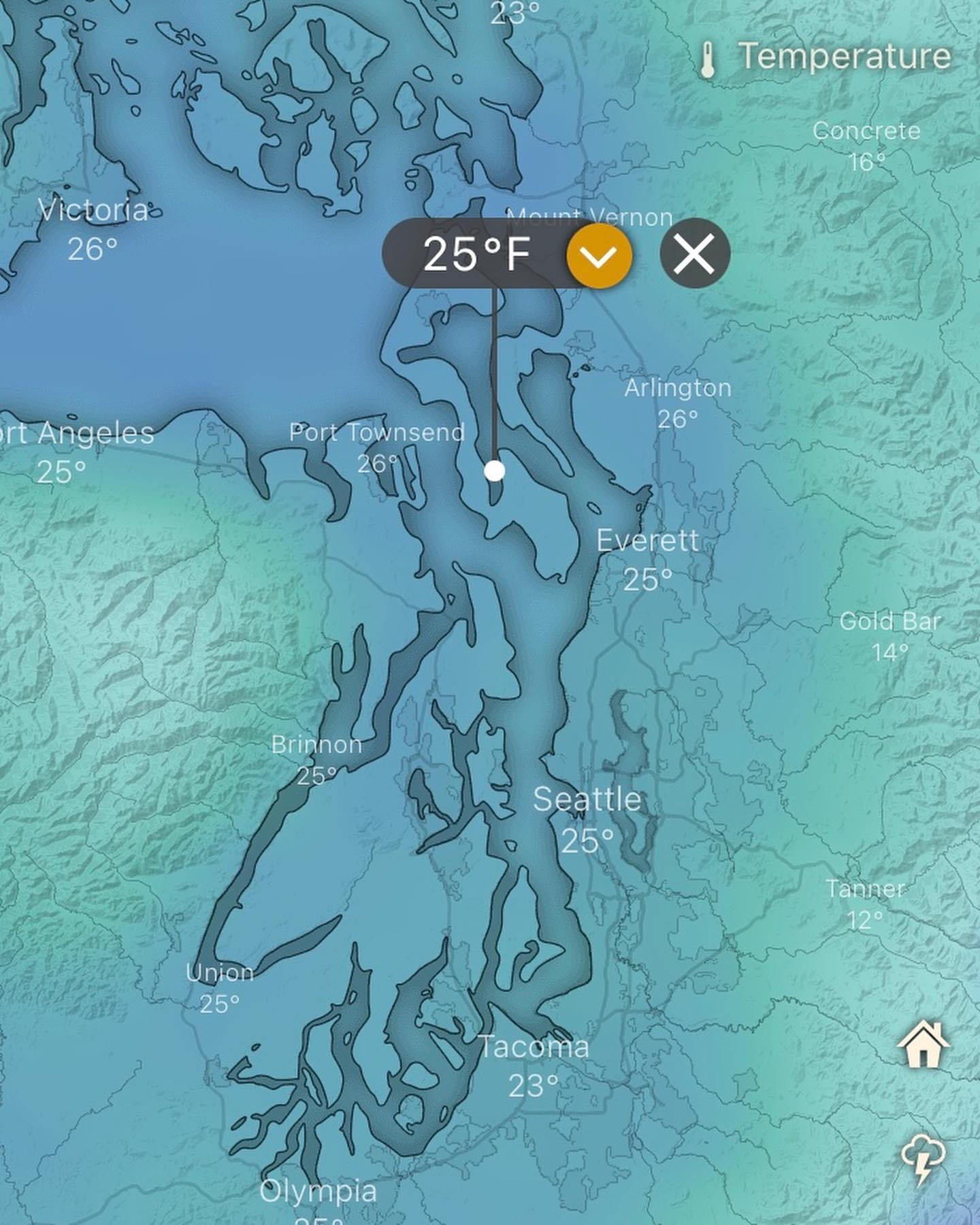
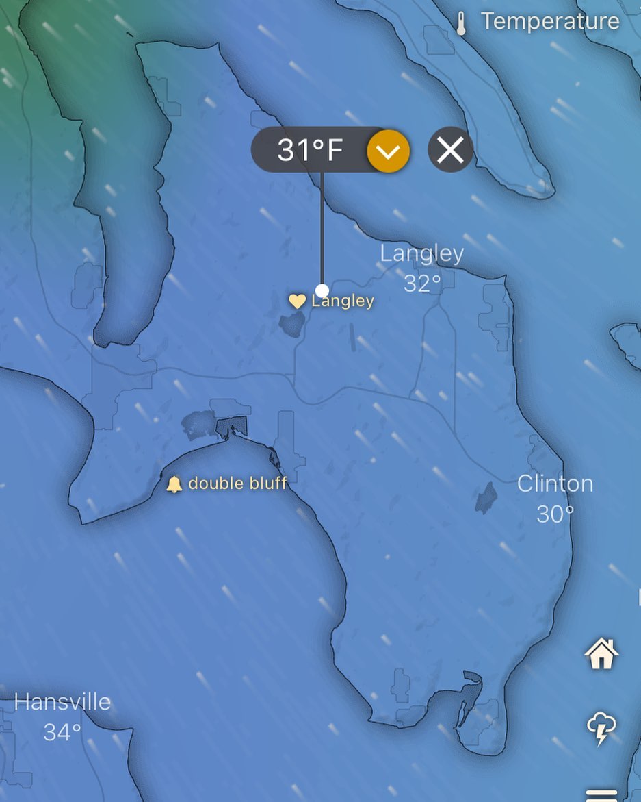
Wednesday our temps begin to fall and Thursday we’re not breaking freezing as high temp linger around 28F 🥶
Best case scenario we wake up Tuesday AM with utilities! 🤞
What do you do to prep for a windstorm? Here’s a few things I’ll do before one:
✅ full tank of gas in the car
✅ propane for generator and stoves
✅ devices charged, headlamps / candles out
✅ extension cords ready
✅ generator ready
✅ handheld scanner charged up (I monitor fire radio mostly)
✅ outdoor cooking stuff ready
✅ groceries for a few days (at least)
✅ non essentials (like beer/books/games)
Still a few days to evaluate this wind event, but as an update to my previous post — things are trending more south now with gusts to the mid 50s. The euro has been under-estimating the wind speeds imo so tack on 5-10mph to that and we’re flirting with 60mph around midnight Monday into Tuesday AM.
Cold temps start Tuesday night into Wednesday so it may be time to start considering your situation in case we are out of power and the temps drop below freezing next week.
Will update again this evening on where this shakes out on the models.
Flirting tonight (Thursday) with some weak frontal systems, couple more into the weekend, but next week is already looking weird on the model runs…
Arctic air returning next week with chances of snow in the extended forecast — but first, a decent looking wind event for Greenbank north late Monday night into Tuesday morning.
Still a ways out, so I’ll keep be posting on it sometime this weekend. Let’s see how it trends on the models…
Bit of a pattern change today. Image is winds expected tonight (Monday) at 6pm. Coupeville looking windy. South end generally not, but our electricity comes from coupeville south so, putting it out there. Don’t be surprised to see a little dusting of snow overnight Monday into Tuesday! (Nothing too disruptive)
The European model is picking up what I was putting down in my last post. Just when I was getting excited to throw down some pea seeds this spring (@deepharvest ones too - you know how we roll) — you can see that this winter season is clearly not done with us at all! #wawx #wasnow #lowlandsnow #wxnerd #sureshot #headsup #itMightSnow