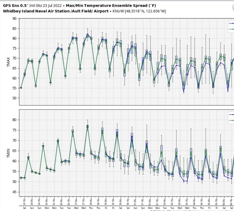
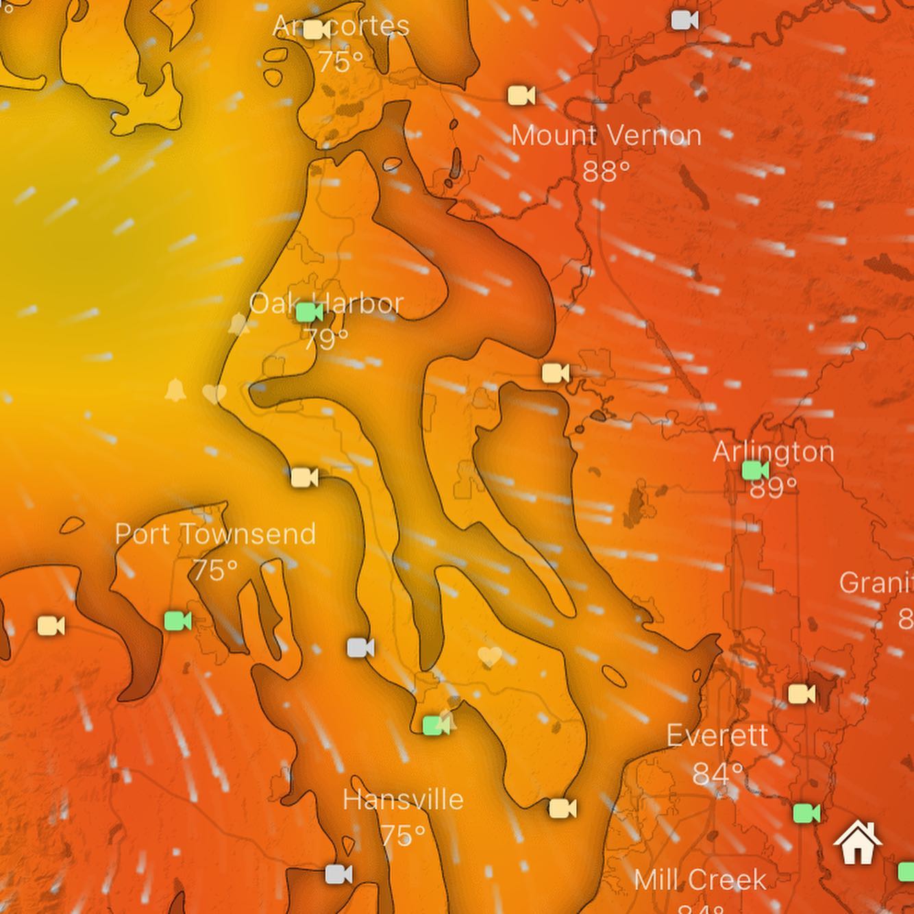
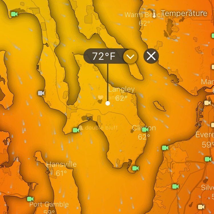
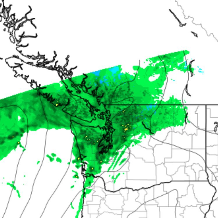
🤩 wow so NAS Whidbey is barely breaking 80 on this heatwave.
🤩 wow so NAS Whidbey is barely breaking 80 on this heatwave. Looks like we might just luck out and stay below 90 here. Friday harbor is even cooler. Whew 😅
🤩 wow so NAS Whidbey is barely breaking 80 on this heatwave. Looks like we might just luck out and stay below 90 here. Friday harbor is even cooler. Whew 😅
Heat update: are we likely to dodge the heatwave? I trust the models less for predicting accurate temps. They tend to do well with precip and wind, but the European model, imo non-professional opinion, seems to struggle with predicting highly accurate temps around puget sound.
Saving my personal opinions on supercomputer weather modeling, the beaches of #fortebey could be nature’s cooling center for this next heat event. If you’re getting too hot, it might be worth the trip.
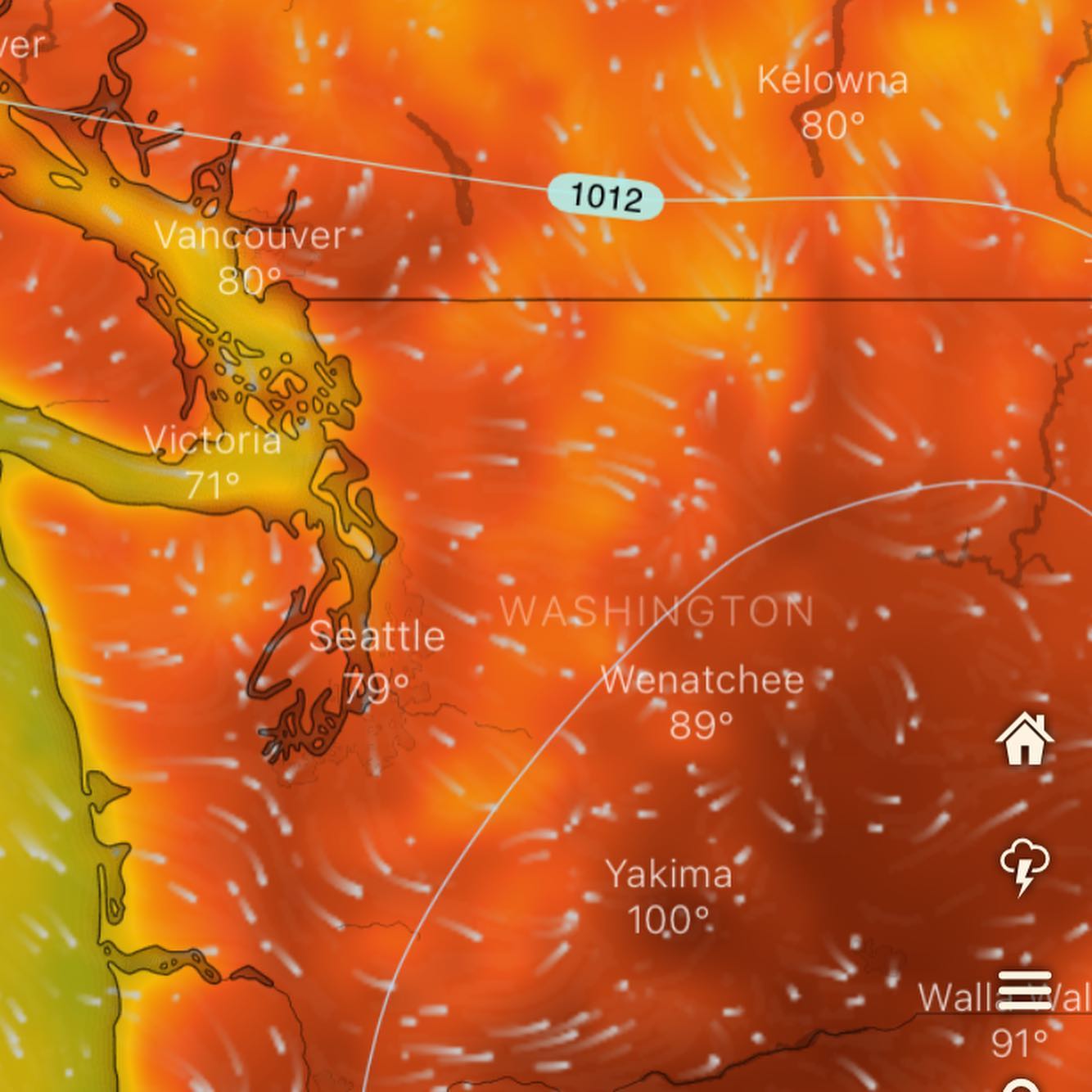
Eastern WA and Seattle south will be aiming for records, looks like Thurs high at SeaTac is 93, so that daily might be given a run Thursday PM.
We may be protected a bit on the South end. I’ll check the HRRR this weekend and update us again on that..
I’ll be enjoying the last of the cooling marine layer clouds Saturday AM before the thermal trough begins setting up shop Sunday PM. ✌️
#waheat #southwhidbey #southwhidbeyweather #whidbeyisland
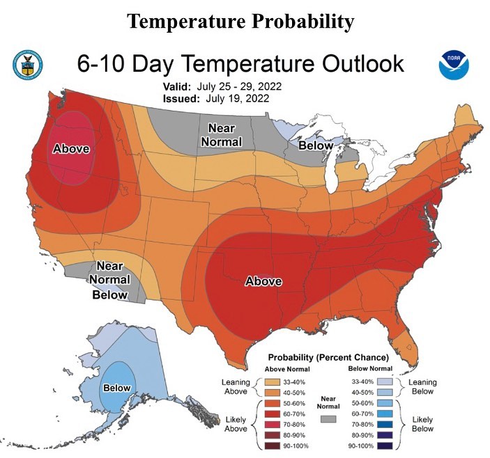
Well well well.. the extended range is looking a bit hot.
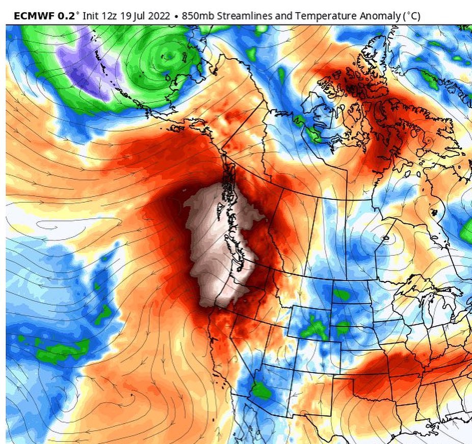
Still a bit too far out on the long range models, but there’s a general agreement among them that we are going into heatwave territory after this weekend.
The weekend, however, is looking cooler, with a pattern of early morning low clouds, burning off into sunshine. Saturday and Sunday we have a chance of staying cloudy all day.
I’m not expecting anything like the “heat dome” aka death ridge of last June, but the models are trending into the mid-90s range after the weak pacific system clears out on Sunday.
Dust off those fans, pickup an extra at the store if needed and I’ll be keeping a close eye on the upcoming model runs to see where we land with the temps going into the next workweek 🥵
#wawx #waheat #waheatwave #whidbeyweather #southwhidbey #southwhidbeyweather
Wed & Thursday looking a little cool, Friday we start warming up. Thankful our highs are in the 80s unlike last year in the 100s.
Soak it up my dudes. Next week looks nice too (not too hot)

Update: the puget sound convergence zone signature today has really dropped off. I’m not seeing any significant PSCZ setting up. And convection is looking minimal. Maybe a few light showers/drizzle at best… hope everyone has a wonderful and restful Sunday. 💜
#southwhidbey #southwhidbeywx #whidbeyisland #whidbeyweather #langleywashington #clintonwashington
Wow that was a wet Thursday! We smashed the record for rainfall yesterday at SeaTac from 0.72 to 1.16in.
What’s next? We should see a second surge of rain mainly for Seattle south with a bullseye on Oregon this afternoon, expect some showers here and there, but we should have a bit more rain shadowing here on the south end as the AR hose reverses back north.
Sunday morning we have a classic convergence zone signature showing on the models with breezy west wind coming down the strait and converging with air streaming around the Olympics and up puget sound. These air masses meet and create steady, drenching rain. And occasionally lightning (probably not likely Sunday)
Might take another look at the #pscz models tomorrow, checking the NAM 3km and HRRR to get a better idea of the pscz activity and where it will set up.
Convergence zone days offer an opportunity to head up to #coupeville north for a sunny, breezy hike to escape the rain 😉
Extended 10 day temps look below average but when that sun comes out it really does warm us up.
Hot gurl summer is still delayed in the extended with troughing lingering into the long term. Expect some nice days midweek next week but we’ll revisit that towards the end of the weekend.
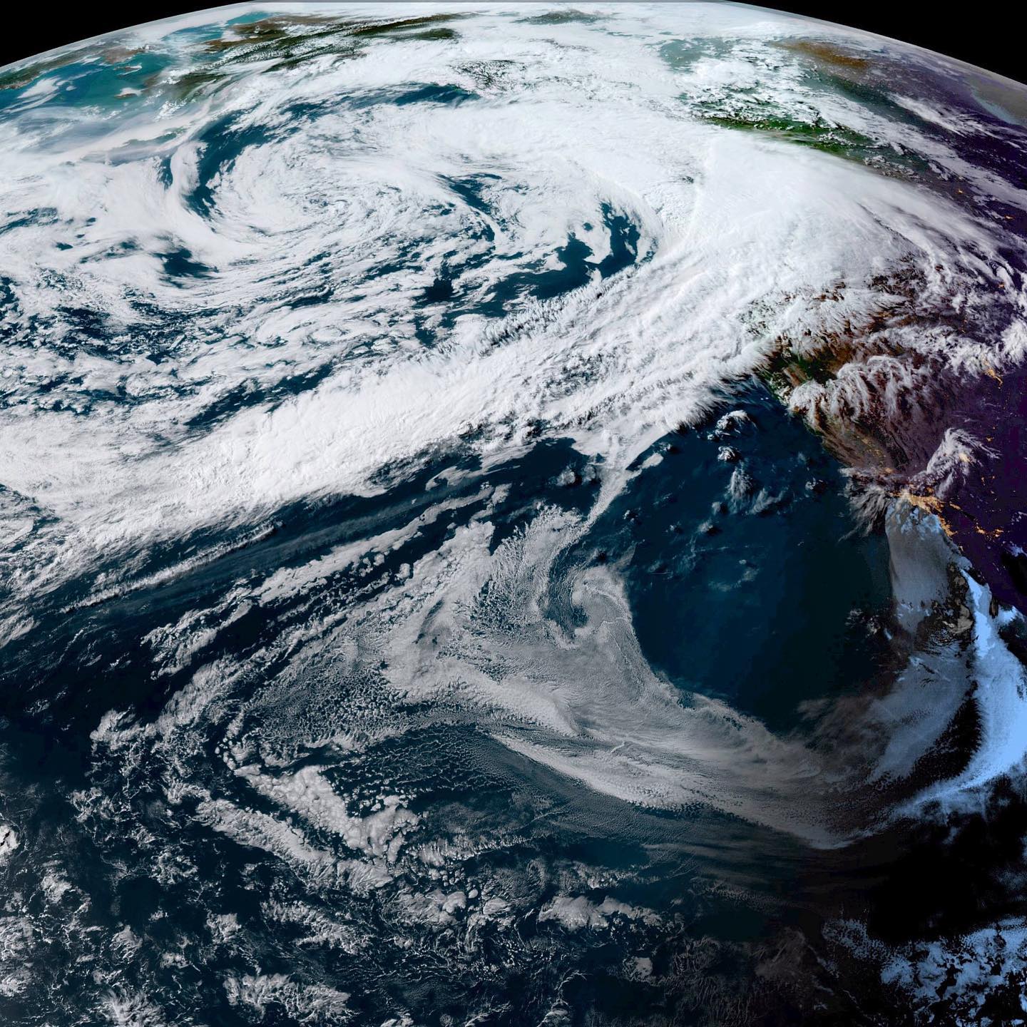
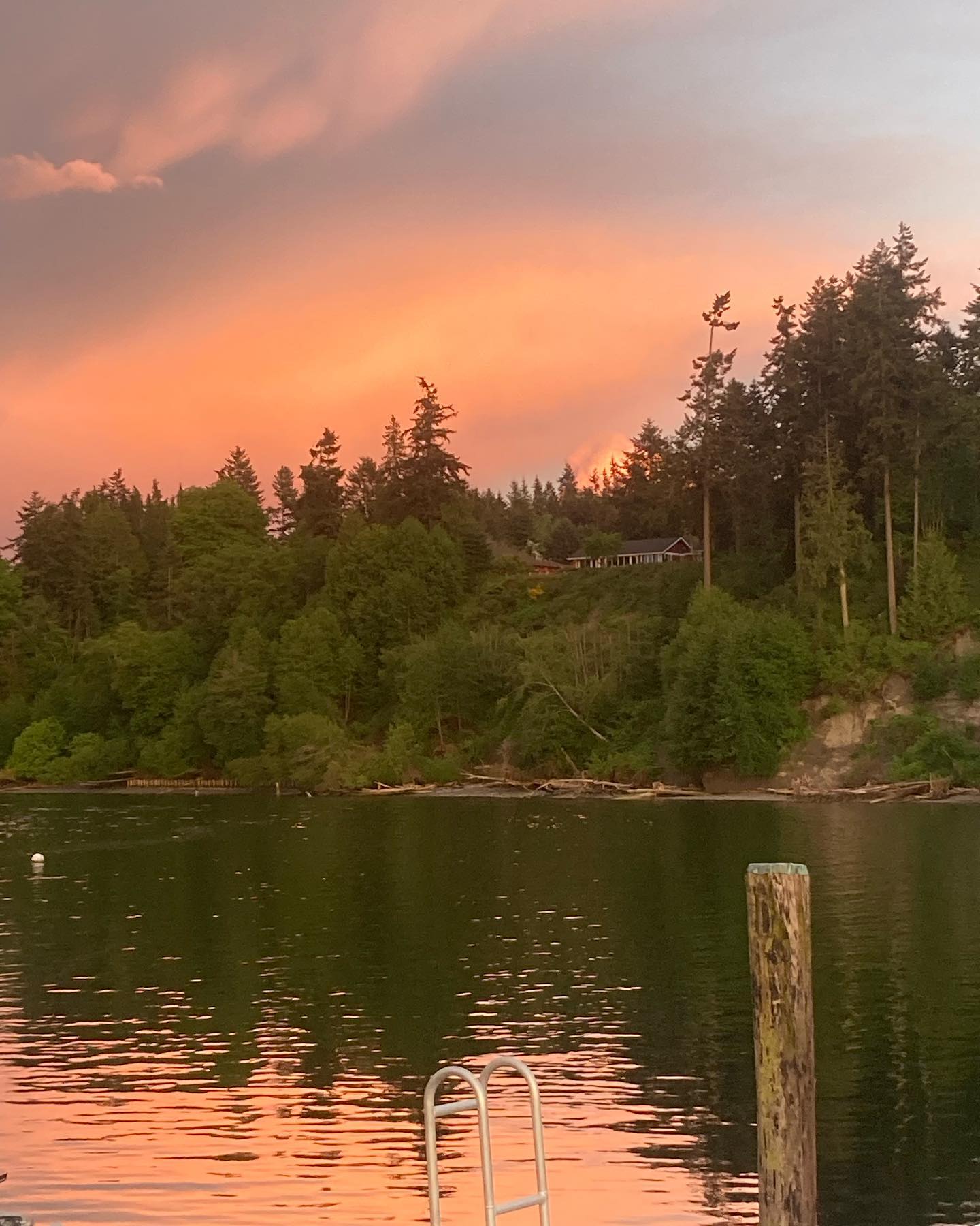
Image: sunset last night from GOES West satellite
#wawx #whidbeywx #southwhidbeyweather #clintonwashington #langleywashington #freelandwashington #greenbankwashington #southwhidbey #whidbeyisland #warain
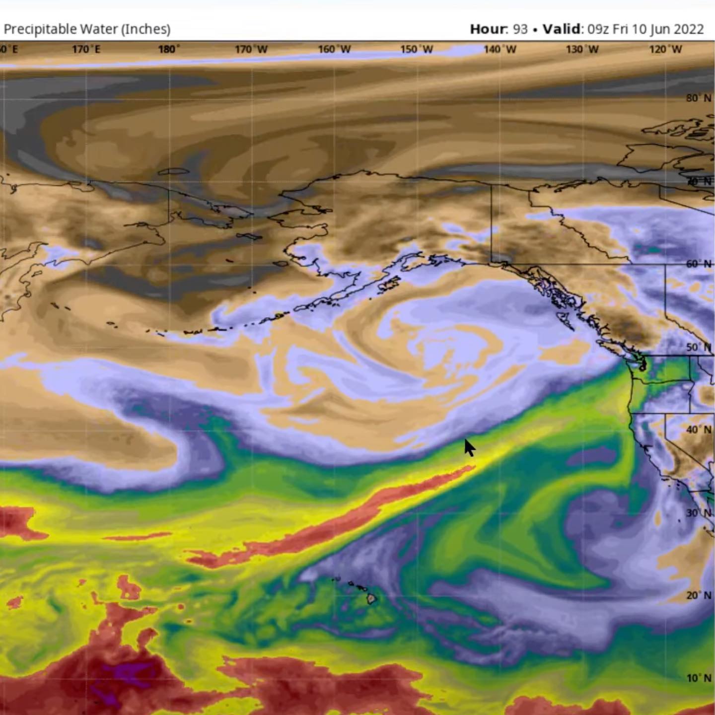
Wow 🤩 here we are in June and I’m here to let you know about a Category 3 atmospheric river event to begin on Thursday. Absurd levels of moisture look to hit primarily the Olympics with spillover to the cascades. Im keeping an eye on what this means for us here on the south end. We will certainly have some rain shadowing in effect but I’d get those seeds ready for deployment because we’re going into the waterfall again here across the region. This is typically a storm I’d expect to see in November, December or January. Maybe just close your eyes and put on some flippy floppies and pretend we’re Hawaii?? Junuary is coming ppl
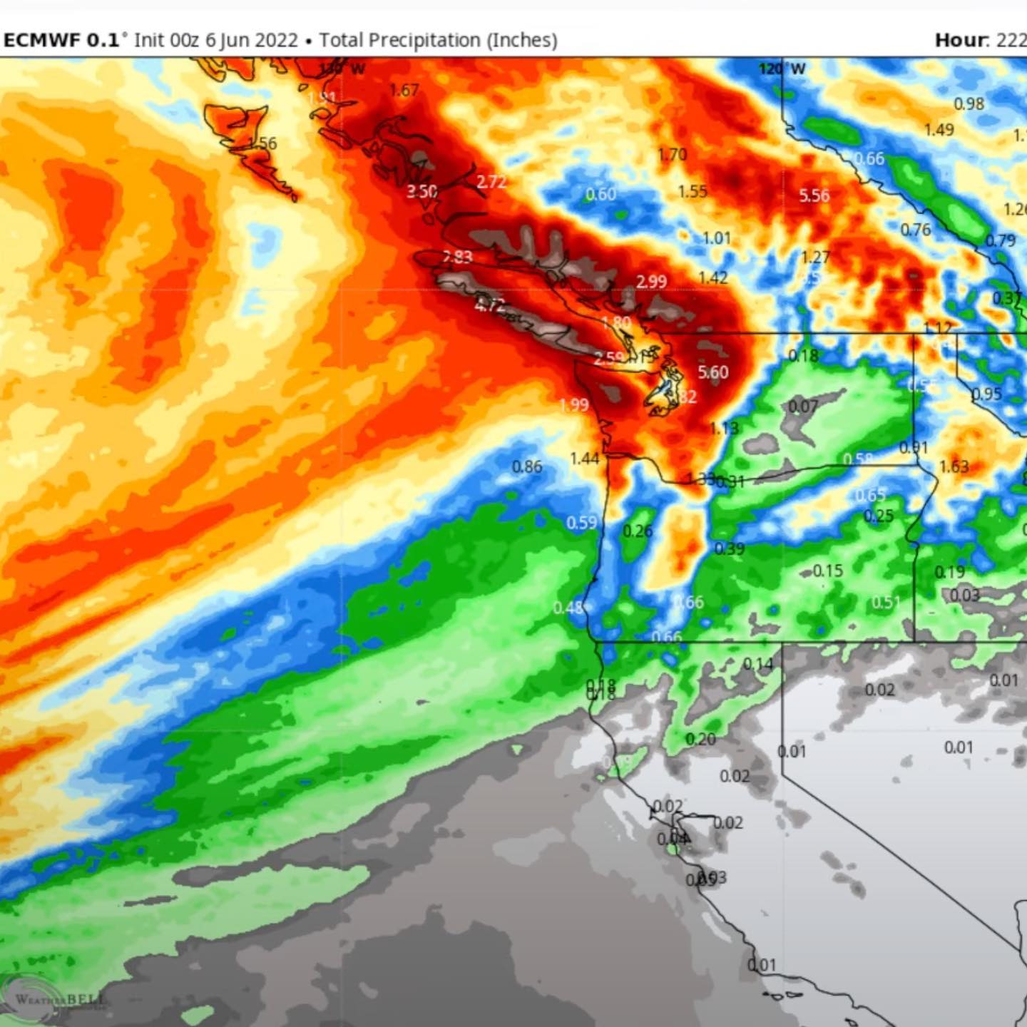
#wawx #southwhidbey #whidbeyisland #whidbeywx #atmosphericriver #warain #junuary #lanina
It’s gonna be a good day if we’re starting off waking up to thunder!!
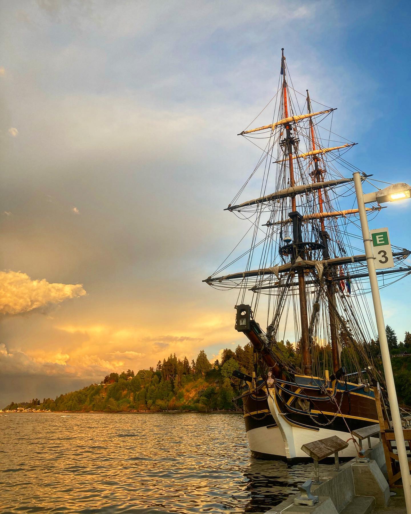
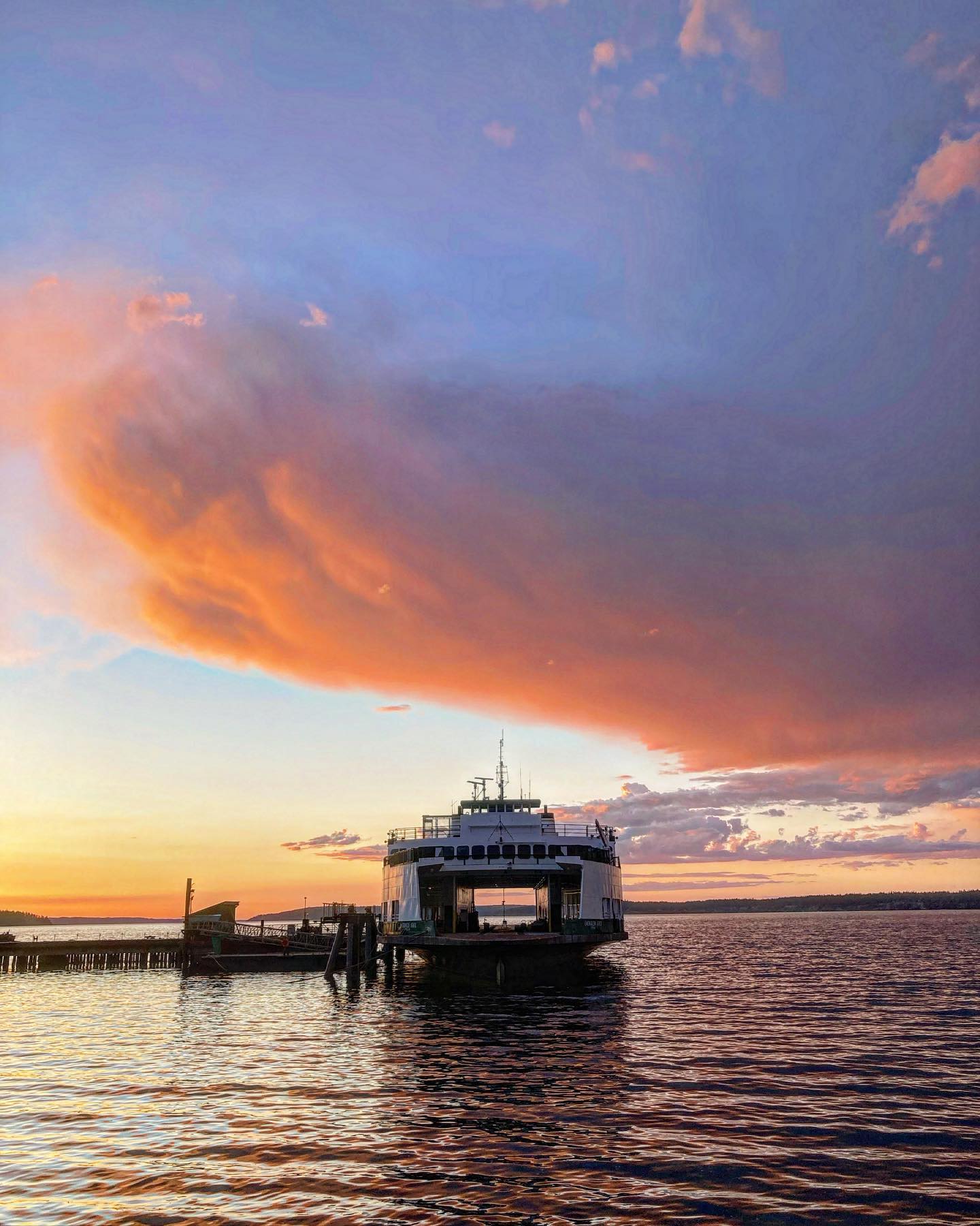
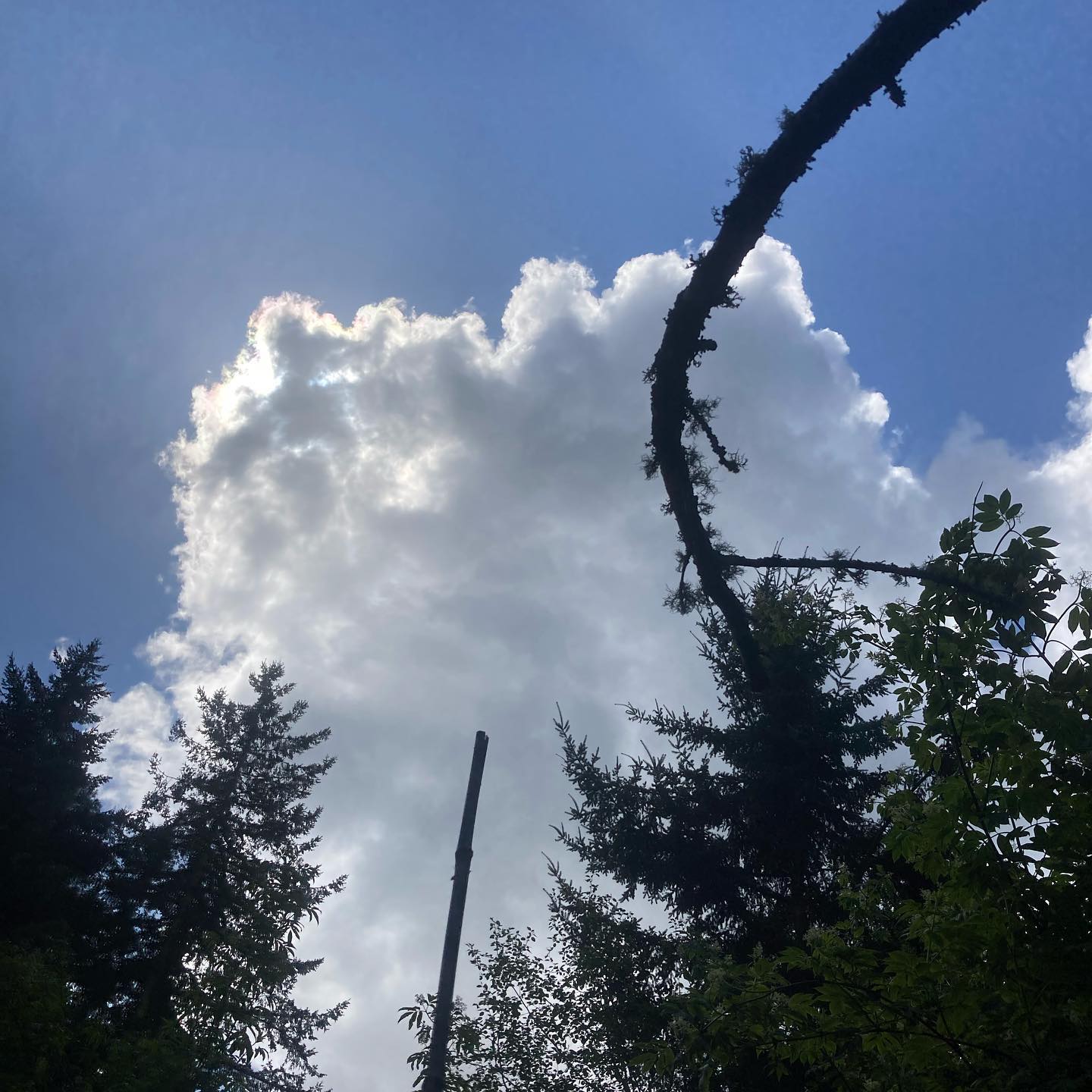
Did anyone else chase the #sunset tonight? Tag me if so.. wasn’t it incredible?? Rainbows, clouds, boats — a big crack of thunder.. Wow 🤩
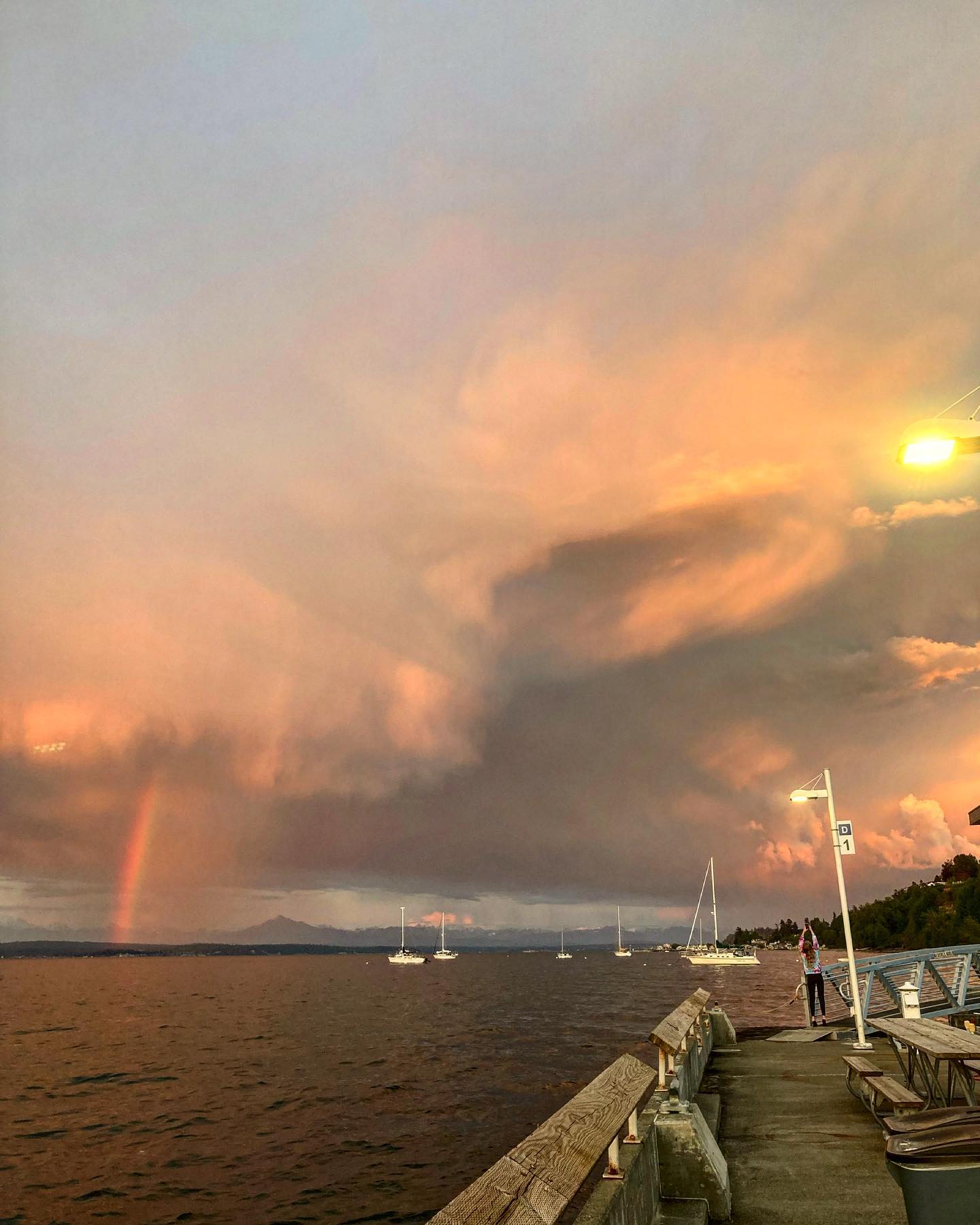
#langleywa #langleywashington #tallship #wawx #southwhidbeyweather #whidbeywx #whidbeyisland #southwhidbey #somagicalferriestakeyouthere
Welp weather frens, alas the long days are here and yes, the sunshine is back for a possible awesome weekend and maybe even a nice Monday. It’s not absurdly hot yet, and each day from tomorrow on will feel a bit warmer. Is it over? Is the winter gone? No. The long range models show a return of some storms but we’re out in variable fantasyland in terms of accuracy on weather that far out. Until then, enjoy the beautiful spring weather this weekend. Get outside if you can!
#pnwsun #spring #pnw #wawx #sun #goodvibes #whidbeyisland #whidbeywx #southwhidbey #southwhidbeywx
Weather or not.. here I come, you can’t hide… gunnnnna fiiind you and make you waaaan
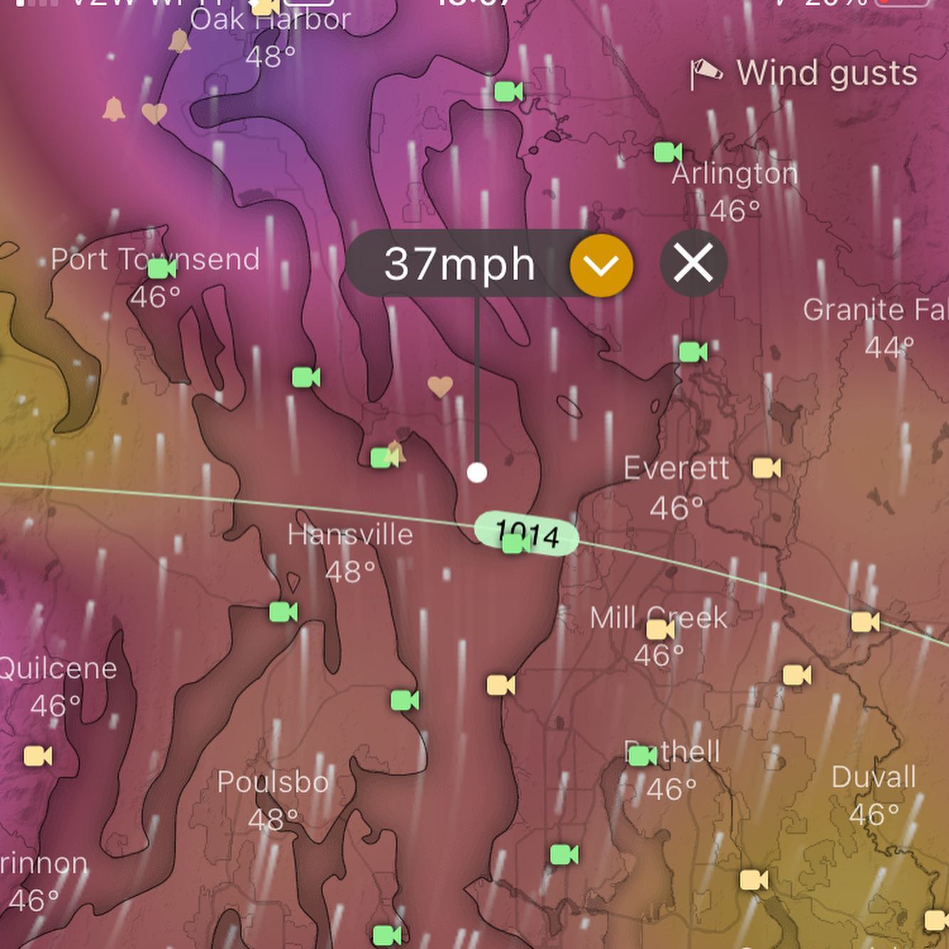
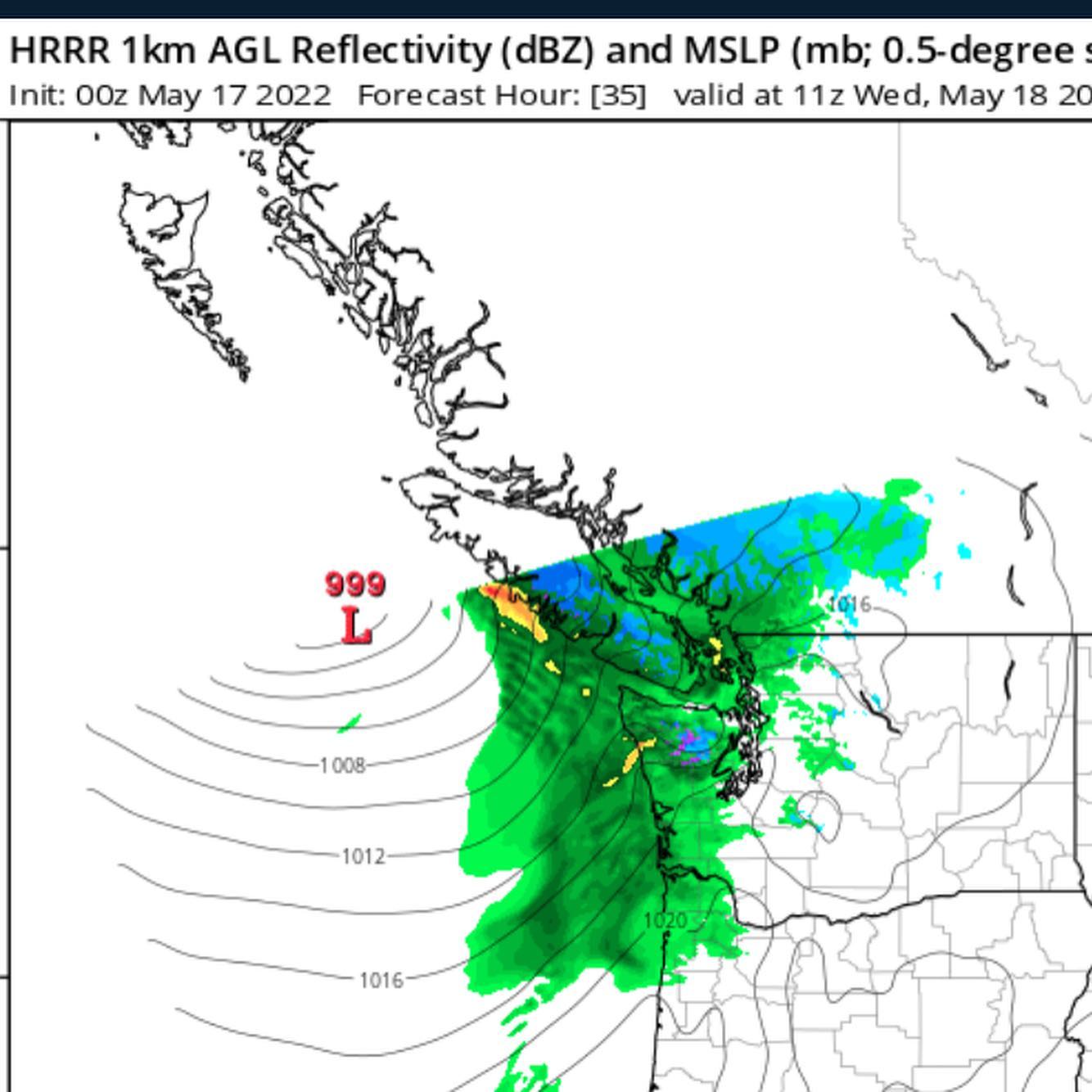
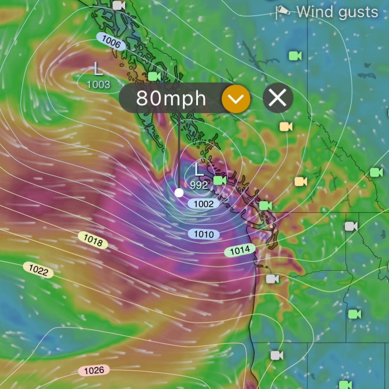
Ok so Wednesday morning we awaken to another potent La Niña system. Wind gradients looking borderline gale force in addition to rain — not really “windstorm” territory per se, but gusts to 40mph Wednesday are likely (slide 2).
It’s always possible we lose power being that it will be more a bit more windy up around Deception Pass and OH. We’re usually OK at these wind speeds here on the south end, but something to be aware of Wednesday.
Tuesday (tomorrow) looking like a sneaky/unexpectedly nice day?? Try to get it in tomorrow during the break because this system is gonna do it’s thing come Wed AM.
Bullseye for this storm is northern Vancouver island (slide 3) with some lively 80mph winds up there. The southerly’s will be feeding this up admiralty inlet and growing stronger toward oak harbor, Anacortes and the San Juans in the usual windy spots.
#wawx #whidbeywx #whidbey #southwhidbeywx #southwhidbey #whidbeyisland #admiraltyinlet #deceptionpass
Rain starts Sunday around 8am… atmosphere looking saturated so I’m expecting my coffee to taste extra cozy with the La Niña spring no spring continuing it’s mood.
Mid week showing zero signs of a hot boi summer with another low pressure situation grazing the island keeping us in the refrigerator.
This is currently the 5th coldest May in weather history for western wa. Can we break the record?
Long range models hinting at some warmth for next weekend but the models are fantasy island that far out.
#wawx #warain #lanina #whidbeyisland #southendwx #pugetsound #pscz
Video from Saturday AM 😍 gotta love the #pscz
Outlook: Wed / Thurs we go cloudy… expecting a pulse of moisture, clouds and breezy winds from the south. Not warm — so if you can catch a sun break get after it outside 🌧🌤
Long range models not looking summer-ish whatsoever with a possible system for Sunday, will get more on that as the wind models may need watching — let’s see how it goes.