👋 hi everyone!
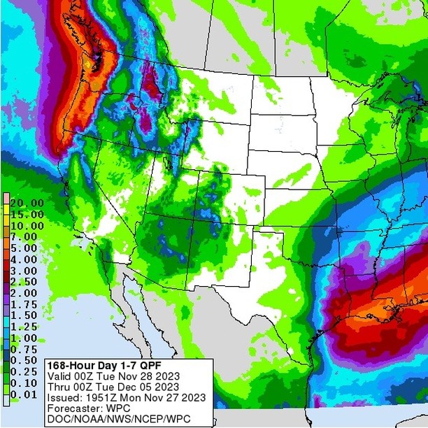
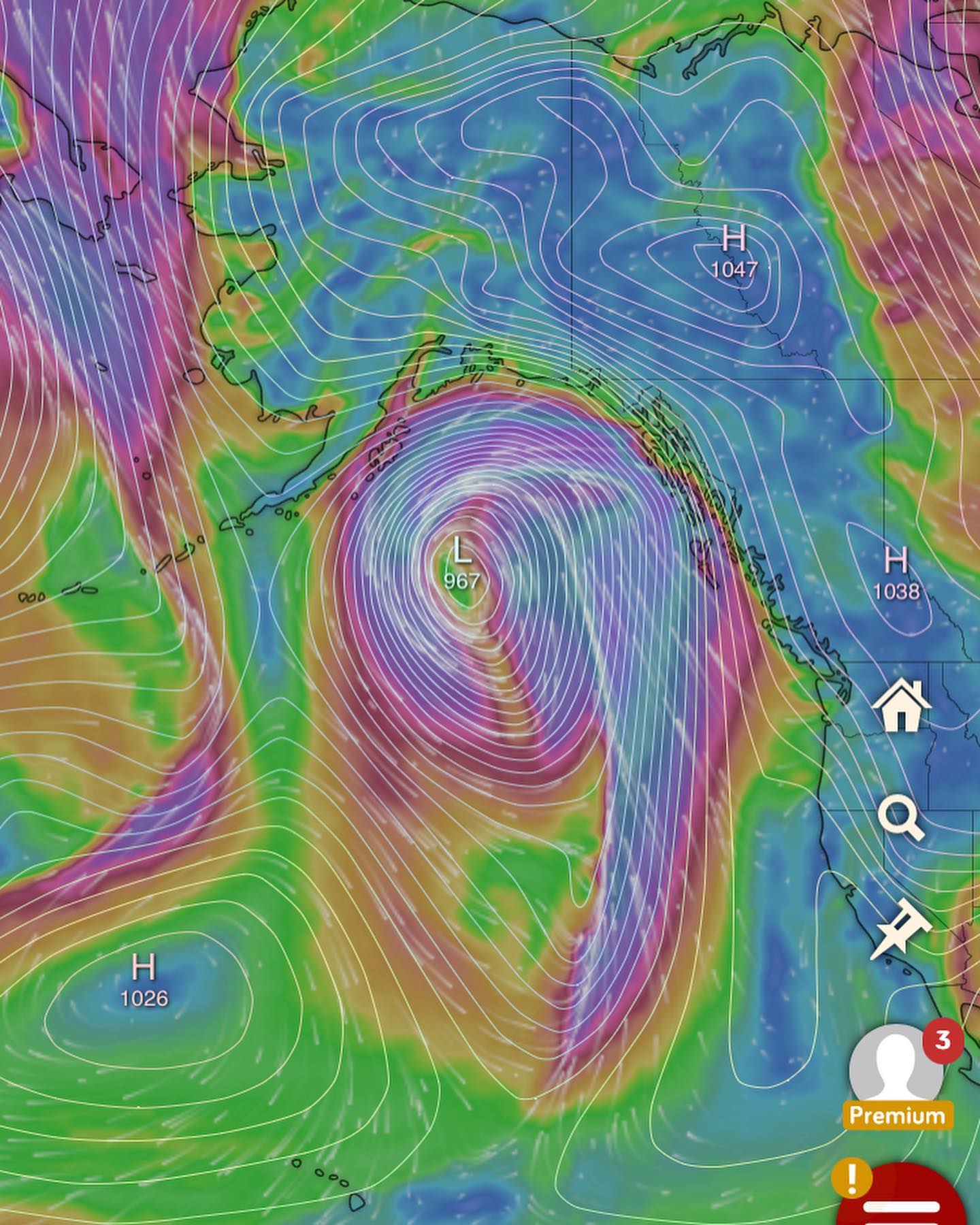
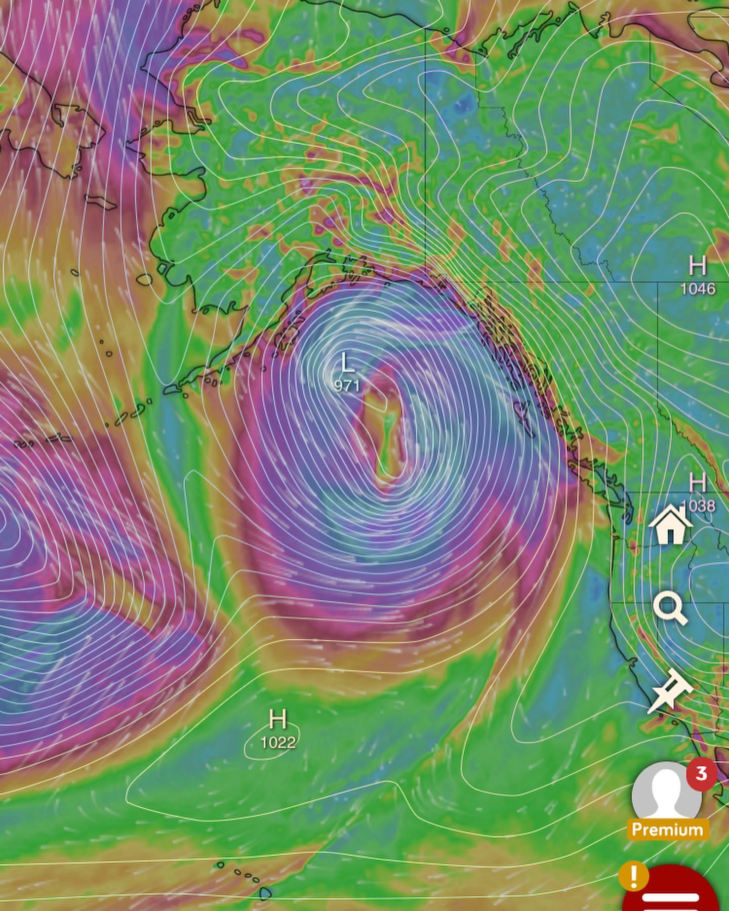
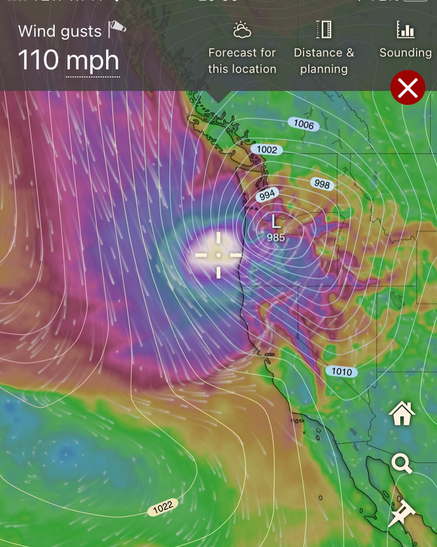
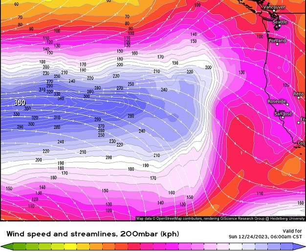
👋 hi everyone! Haven’t been seeing much in terms of extreme weather for us, BUT - I’ve been eyeing the extended forecast (i.e.. after Christmas day) and it’s looking like the west coast will be going into a very interesting pattern after Christmas day.
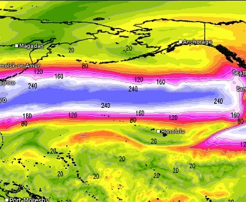
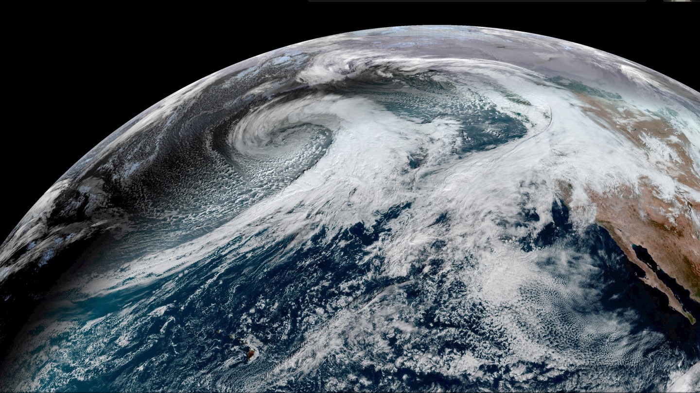
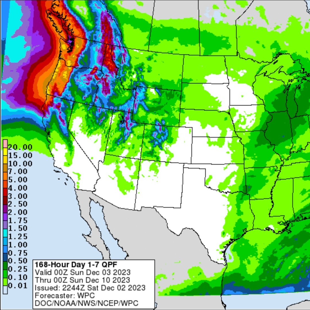
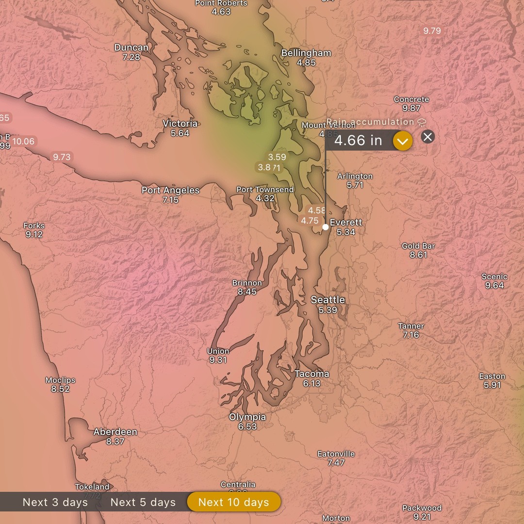
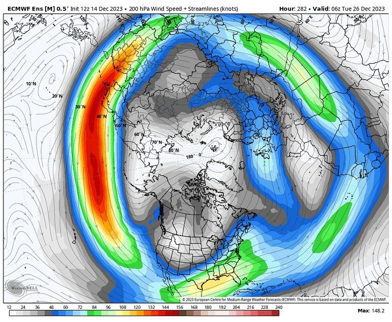
At this point, long range models (GFS and Euro) are in agreement on a very powerful jetstream unloading on the west coast for many days.
What does this mean for us?
-
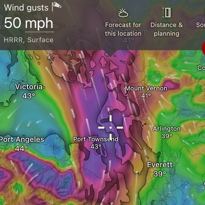
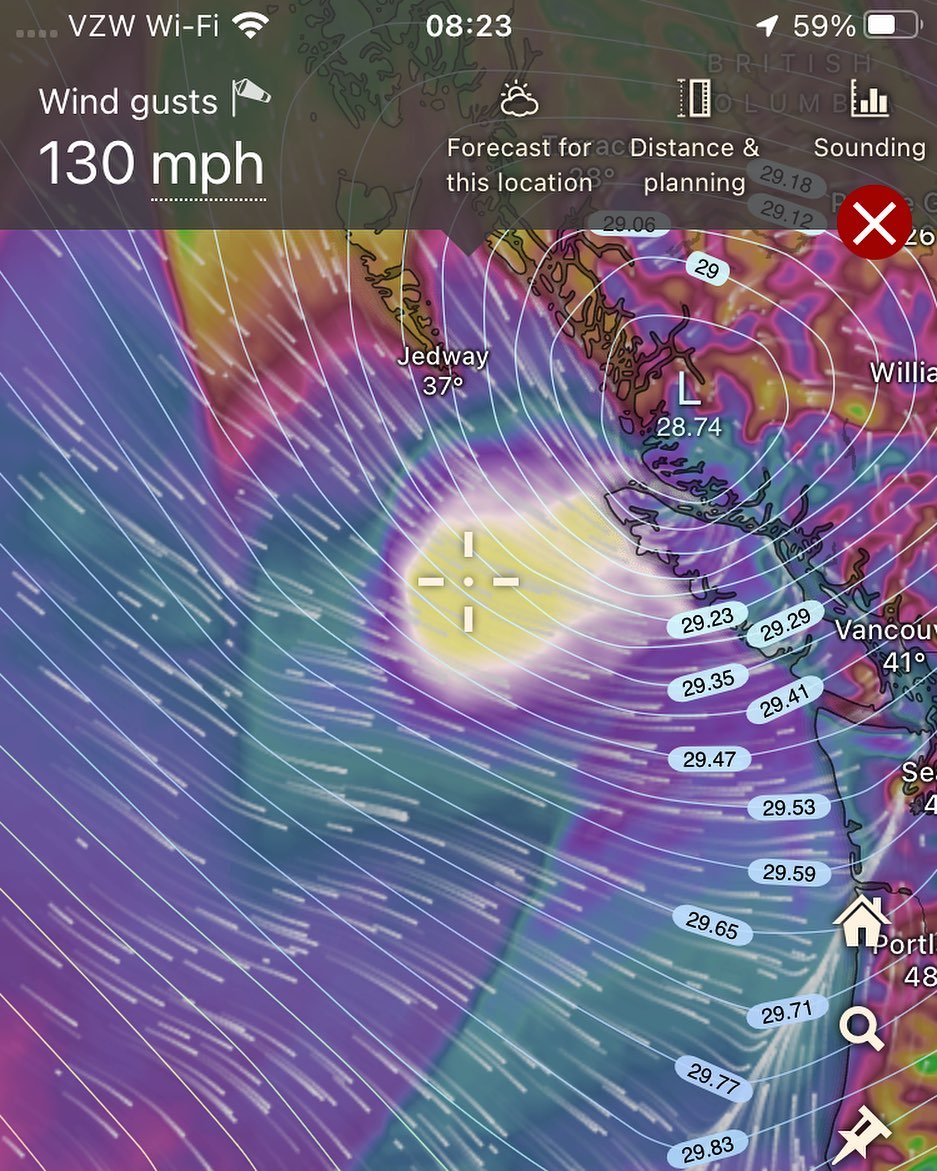
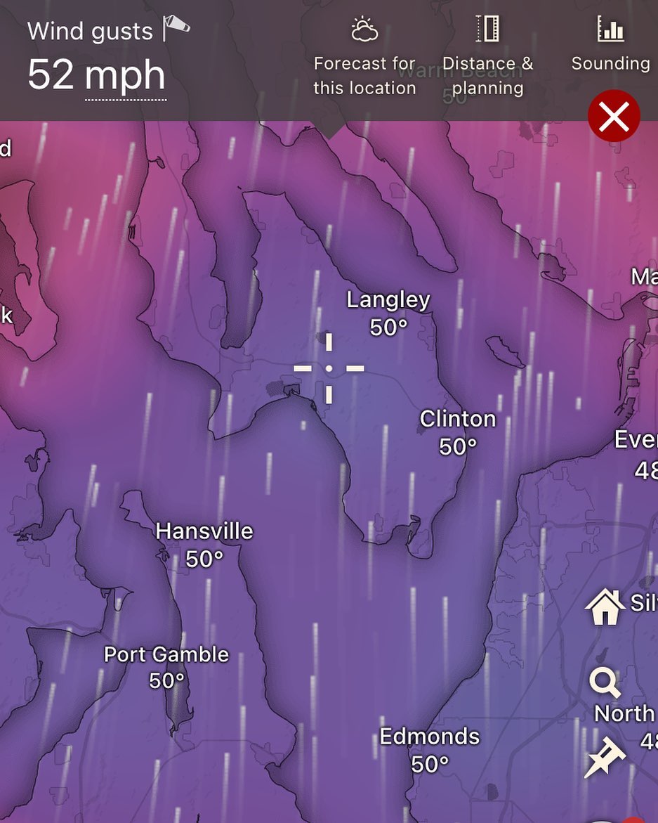
Increased chances of powerful storms, including windstorms.
-
Slightly above average temperatures (as in we’re not likely to get snow/frost at sea level during these patterns)
-
Slightly higher snow levels for the cascades (but still snowing at higher elevations)
-
Chances of windstorms.
-
Chances of windstorms.
-
Chances of windstorms.
Still too far out to glean any type of accurate forecasts, just expect to be on our toes toward the end of December.
Someone is going to get powerful storms between BC and Baja, where exactly is tbd
Stay tuned…