Another day below our first AR event of the season. Doesn’t get much more textbook than this, with a beautiful stream of beneficial rains for many drought flagged areas of the northwest.
Some uncertainty around a “sneaker” storm late Tuesday night. I’m going to update tomorrow on that.
Models are struggling to produce consistent results, and these little sneaker storms have caused issues for us before.
Weekend looking like a ridge will rebuild over the northwest, so we have good potential for some sun this weekend.
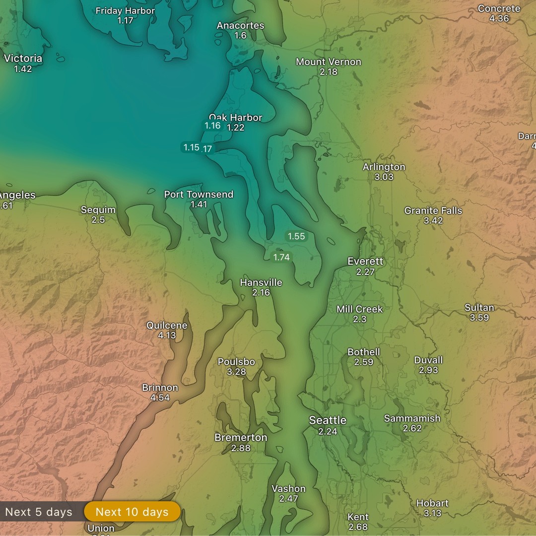
Weak system from yesterday still with us tonight (Sunday). And as seen in the loop recorded today, we’re about to be impacted by the first atmospheric river of the season.
Rain shadow is strong on this system (for whidbey). The Olympic mountains are wringing out the bulk of the rain with up to 8in expected in the high country of the Olympics.
We fare much easier in the lee with the same system bringing us about an inch and a half of rain.
Mon, Tues and Wed will be breezy (from the south) with showers/rain. We may see less rain shadow if things turn more diurnal and we get a more easterly flow.
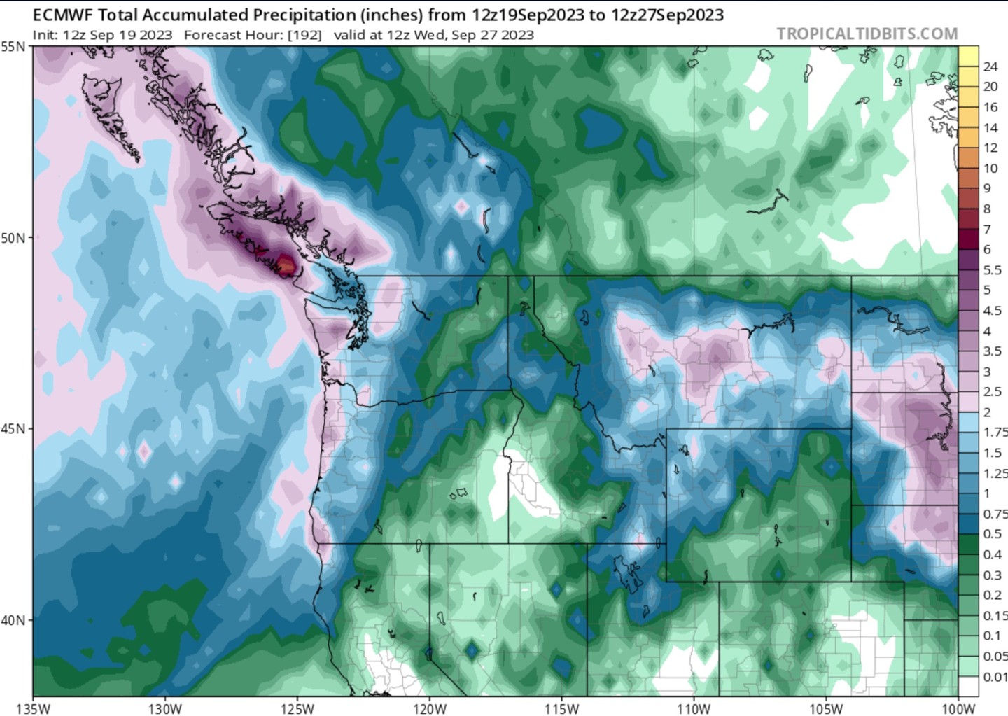
Total precipitation for the PNW thru the end of September tells the full story. Spooky szn is here. Fall is coming. Break out the sweaters folks, we get a little “last call” warmup thurs and friday, and then fall arrives with a storm train of systems.
Still dialing in the details on timing on these systems and some possible wind events.
More soon… like, follow, subscribe, share and turn those notifications on 😜 this winter should be interesting
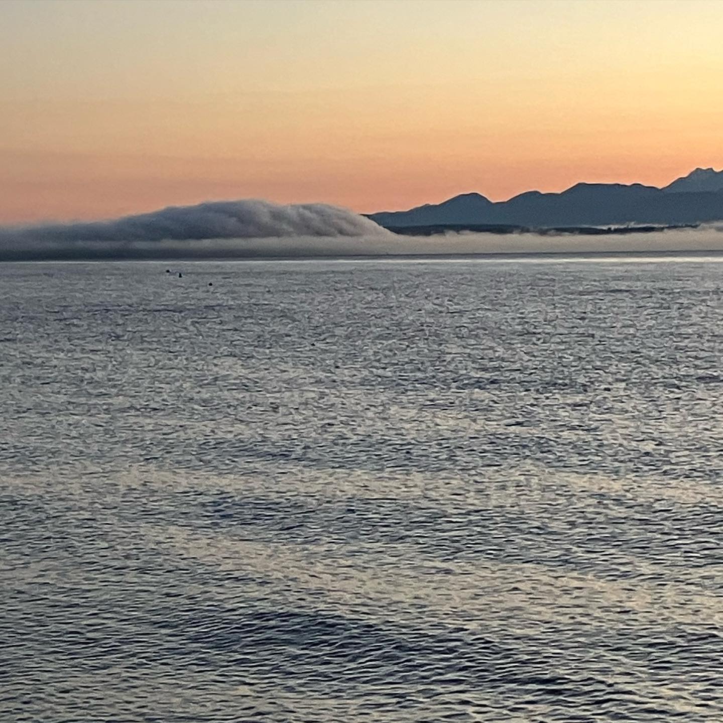
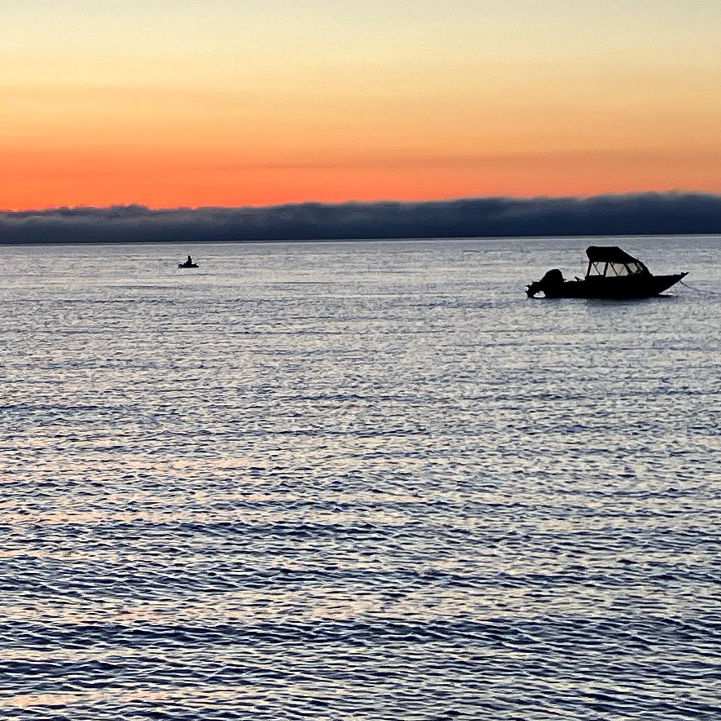
We’ve had some dramatic foggy mornings in MA9, and the wildfire in ONP has really taken off in the last few hours (seen here)
I believe this is the #EaglePointFire or the #MartinLakeFire - last I heard fire officials had it boxed naturally and are letting it run in steep terrain, lots of standing dead trees in that area. Will likely benefit the ecology for decades if it doesn’t get too hot.
Currently some confusion out there about this fire. Good news is temps are dropping and clouds increasing Sunday into early next week. Some light rain expected.
Tomorrow’s instability is finally showing on the visible loops tonight (1030p Monday).
Helps to see the infrared first.. if you look closely you’ll not the massive low pressure system transporting and funneling deep pacific moisture. The moisture is transported around the low and slowly approaching the northwest.
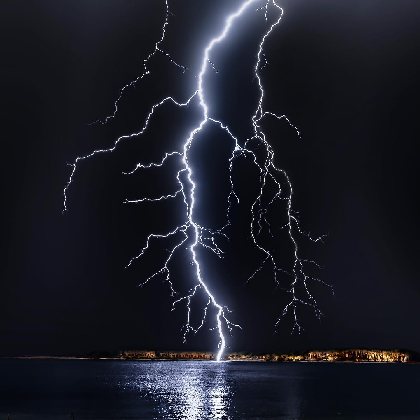
San Juan // Vic Island were getting lit up today on the tail of this massive low. Was quite the hotspot (see slide 3 for the lightning density).
Let’s see if these models are underplaying or overplaying the show?
Looks like tomorrow around 10am are best chances for big thunder.
Later in the week, another round of rain is showing on the models.
Thursday looking promising for rain chances, not seeing much for thunder on the Thursday system however.
Tag @south_whidbey_weather if you get a good video/picture of the storms tomorrow!
We start to warm up Thursday and more Friday with a fairly hot weekend expected.
I don’t think it will be as hot — or as smokey — as our last run of heat, but there’s some uncertainty surrounding that.
I recently took some time off in the cascades, and the levels of fuels and standing dead pine is striking to say the least. It’s a strange feeling knowing our forests need cycles of fire to remain healthy, but also knowing if we get ignitions it’s not going to be anything “controlled” with smoke and AQI into extreme levels for all of us.
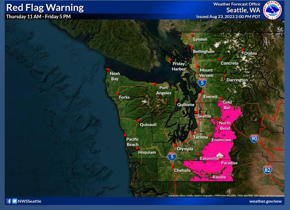
That said, red flag conditions return to most of the cascades this weekend with two impacts of note, low RH (humidity), and eastern downslope winds beginning Thursday night (not Whidbey — this is for the Cascades). A third situation is a decent shot of overnight thunderstorms Thursday into Friday for the mountains too.
If we don’t see any new fires in the cascades from these aspects converging, I’m not expecting AQI on whidbey to be any worse than it was last week.
We will need to see how the Cascades fare during this next run of red flag conditions…
Whidbey looks relatively cooler than anywhere else around the Salish. I don’t think we’ll be over 90F but likely in the 80s sat/sun.
Will update Thursday on the fire conditions in the mountains.
A look at a super rare weather event (last time was 1939) with hurricane hillary being sheared and forced up the continent between two major pressure systems. Wild!
Smoke is looking like it will begin to scour out Monday and Tuesday for us… We should see some improvement tomorrow as we welcome another pacific trough and west wind from the pacific.
North end of the island may see some light rain by Wednesday, maybe a trace of precip on the south end - which should scrub out any remaining wildfire smoke.
Thursday / Friday we warm up again, tapping about 80F on Friday -
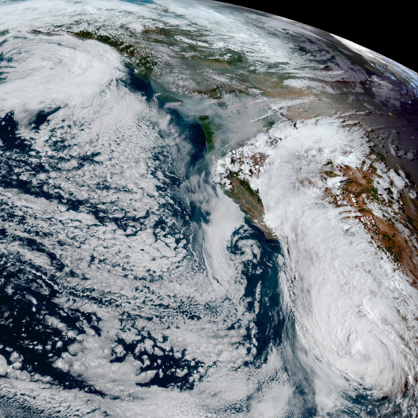
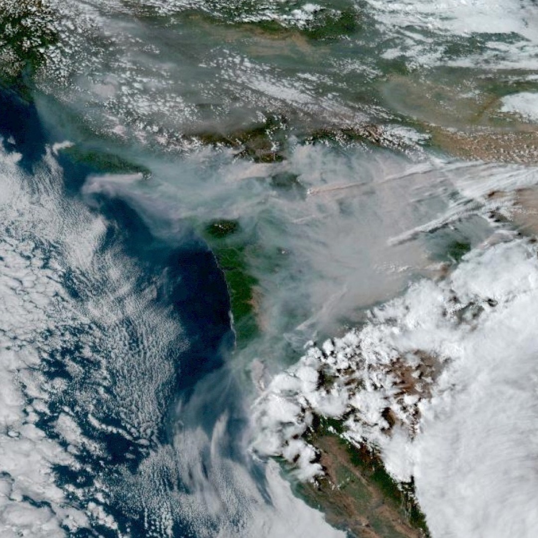
The view from space Saturday - smoke will be a problem tomorrow… also a view of the massive storm already impacting Baja California and the desert southwest.
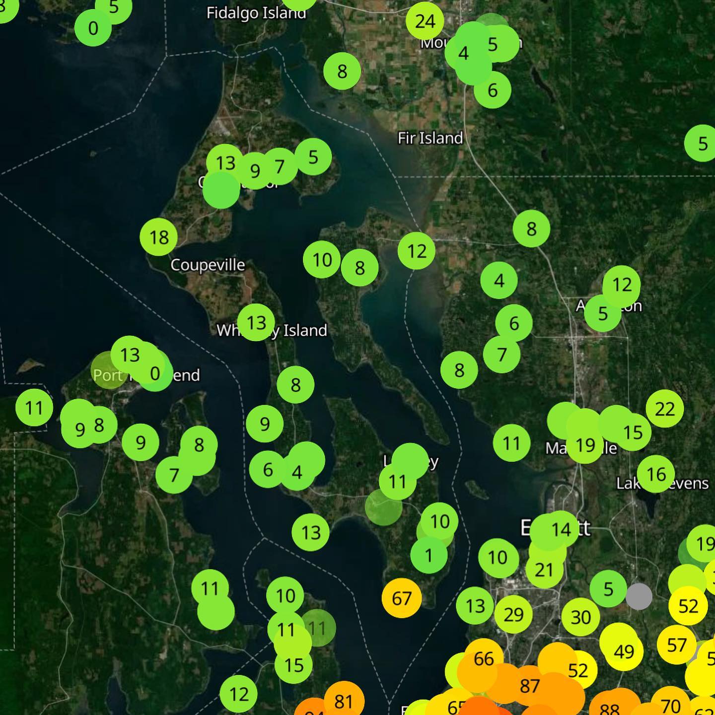
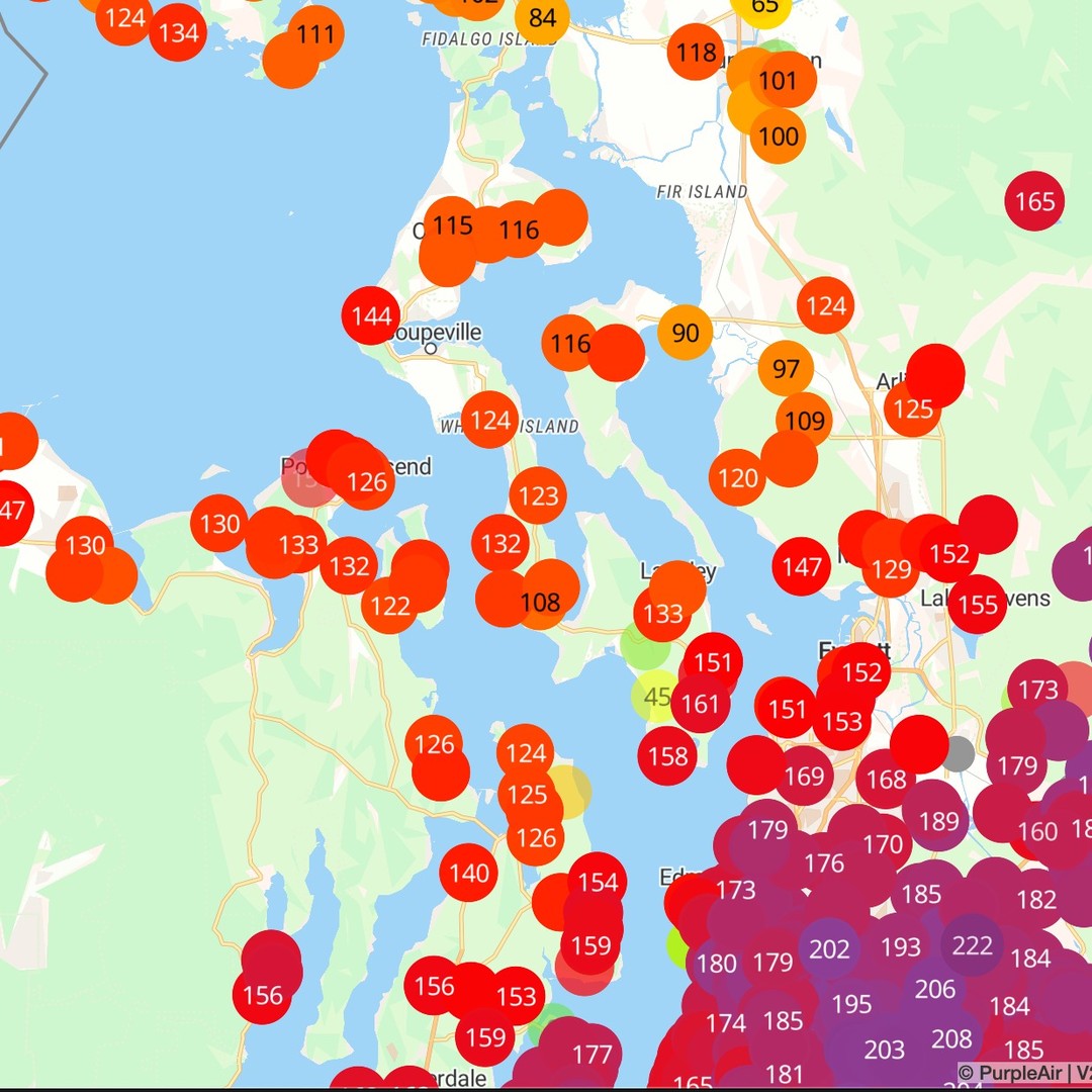
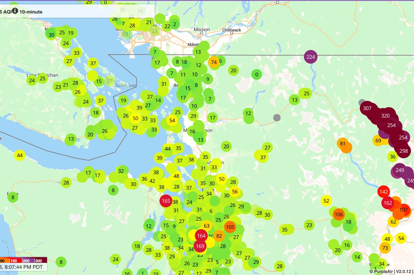
Stay safe out there tomorrow Whidbey - take it easy and hopefully we see some westerlies down the strait. Not sure it’s going to be enough to scour out the air, but we might get lucky. AQI is already 192 on Saturday 8/19 at 9:45pm in Langley. Worse tomorrow.
It’s Friday evening - my favorite time to nerd out on the weather! Certainly no shortage of weather shenangins impacting the west coast this weekend, including a Tropical Storm warning for Tijuana/San Diego/LA for the first time since 1939.
Locally, on Whidbey, we finally got that relief from the heat in the form of seabreezes and cooler temps today, with some areas about 20 degrees cooler than they were yesterday.
Regionally, the same system ushering in the relief here today was causing extreme fire weather in British Columbia, with existing fires in BC “blowing up” today, and a handful of new starts up north.
Unfortunately, it seems the smoke is coming for us, and it’s looking like Sunday we’ll be under generally gross amounts of smoke with an AQI pushing unhealthful levels. Not what I want to type tonight, but the good news is it seems short-lived, with a westerly surge expected Monday and Tuesday next week.
I’m curious if we see a solid westerly surge Sunday down the strait into Coupeville maybe we get lucky and see some clearing?
Will need to update on that tomorrow.
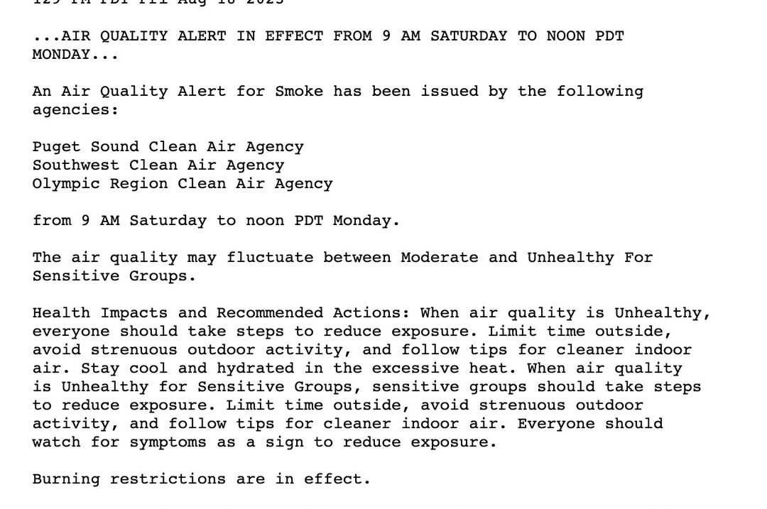
Weather officials are issuing strong warnings for Red Flag conditions in the Cascades this weekend, but even without local fires we may see some pretty extreme smoke this weekend from BC (Sunday mainly).
Will update tomorrow (Saturday) on the smoke situation…