Watches and warnings being issued left and right from the officials over the next few days, and the satellite doesn't lie..
Watches and warnings being issued left and right from the officials over the next few days, and the satellite doesn’t lie..
Mid-level water vapor loop showing the beginning of a classic “Kona Low” north of the Hawaiian islands ready to merge into an impressive jet aimed directly at the northwest. (That’s the system behind the galaxy shaped storm on the slides – this will become our Monday / Tues storm)
Comma-shaped storm ahead of that one arrives tomorrow for another decent slug of moisture Sunday.
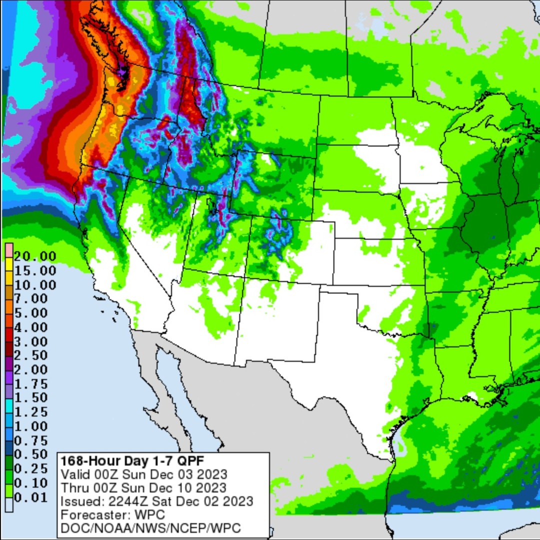
Atmospheric River event for Monday/Tuesday looking downright impressive for rain totals around western WA.
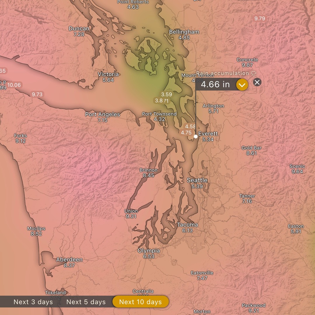
Not much for rivers or mountains here on the island, but either side of us the situation will be dramatic with snow levels moving from 2,500ft to over 10,000ft for the big event in both the Cascades and the Olympics.
Possible we have minor issues with the high tide Tuesday if the bay is swelling from runoff - happened last year in the maxwelton and columbia beach areas, among others. But that was during “king tide” so maybe the 9.5ft rather than 10.5ft will spare us trouble.
No wind advisories with these, and we’ll be rain shadowed as usual, but the PWAT levels are likely render our rain shadow mostly useless.
Rain: 3 - 6” expected in the lowlands 10 - 15” expected in the Olympics and Cascasdes
#wawx #warain #waflood