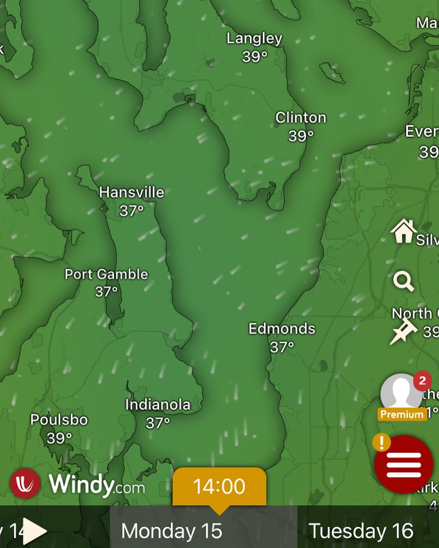
Looking like we have a slight chance of warming up above freezing Sunday afternoon, then dipping back below freezing overnight Sunday… and finally by Monday afternoon the polar air \*should\* be gone.
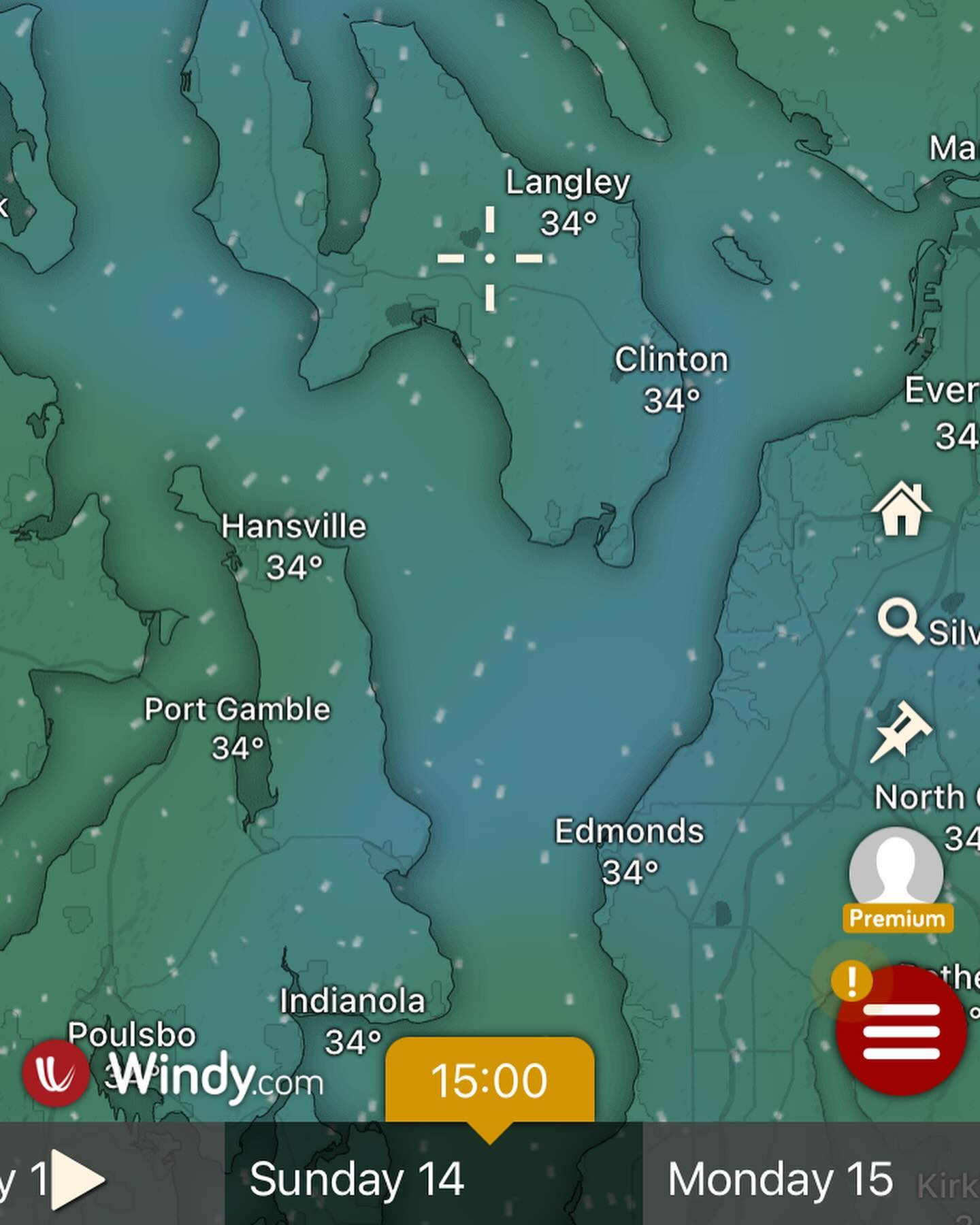
Looking like we have a slight chance of warming up above freezing Sunday afternoon, then dipping back below freezing overnight Sunday… and finally by Monday afternoon the polar air *should* be gone. Polar air is notoriously slow to leave however so everything here is subject to change.
Storm I was tracking for changes is digging into Oregon today, and if you happen to be traveling I-5 between Portland and Eugene today may God have mercy on your soul. Will likely see some news headlines out of that one. Appears to be a freezing rain situation.