With all eyes on the east coast bombogenesis, we should see some relief from the cold foggy cycle with a weak/moderate frontal system pushing through on Sunday.
With all eyes on the east coast bombogenesis, we should see some relief from the cold foggy cycle with a weak/moderate frontal system pushing through on Sunday.
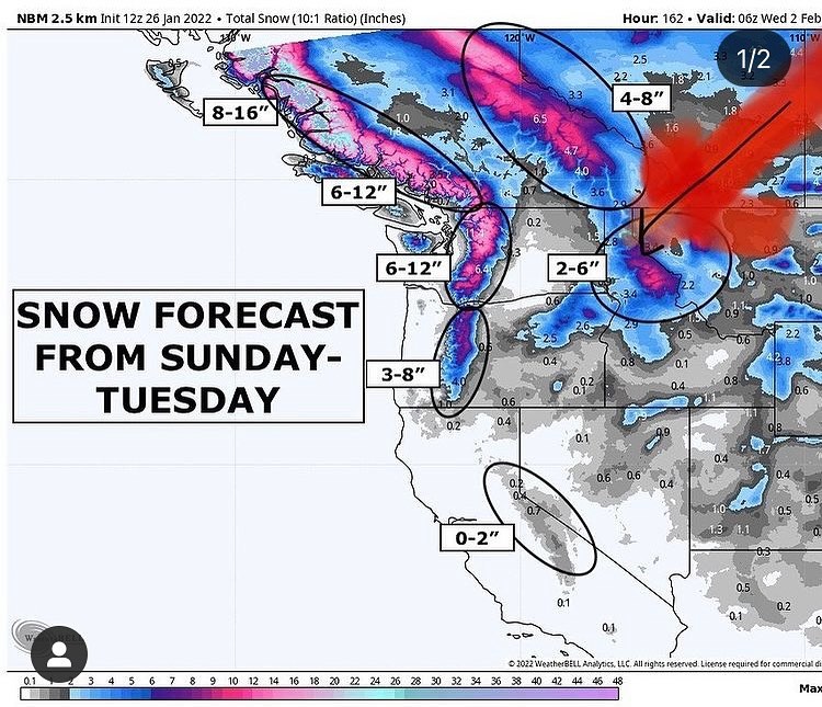
Good dose of snow up in the higher terrain, with rain down in our zone expected Sunday / Monday. The track favors rain shadowing for the south end, so I’m expecting under an inch of precip here at the house.
Should be good enough to kick the foggy gloom out and refresh the air quality a bit. The inversion I’ve noticed has been trapping everyone’s smoke down low as discussed last post.
Nothing super extraordinary with this system but we should see a decent PS convergence zone setup so you may see a few flurries down here, and things can get “variable” with the PSCZ. There’s always hope for a random inch of snow or a lightning strike..
Winds not looking too extreme with southerly gusts to about 30MPH.
With our soils dried out a bit I’m thinking this all makes for a rather uneventful late weekend storm system.
Long range models are disagreeing on what comes next so I’ll try and take a look after the next Euro and GFS runs are finished and see we can’t figure out what’s coming. Looks like another shot of precip behind the Sunday system but will get more on that once these computers start agreeing.
#whidbey #whidbeyisland #wawx #southwhidbey #southwhidbeywx #whidbeywx