Well well well..
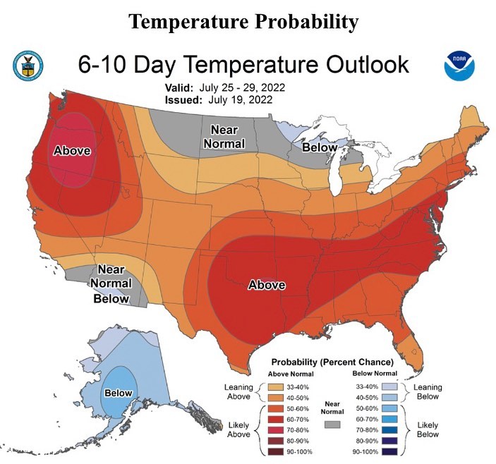
Well well well.. the extended range is looking a bit hot.
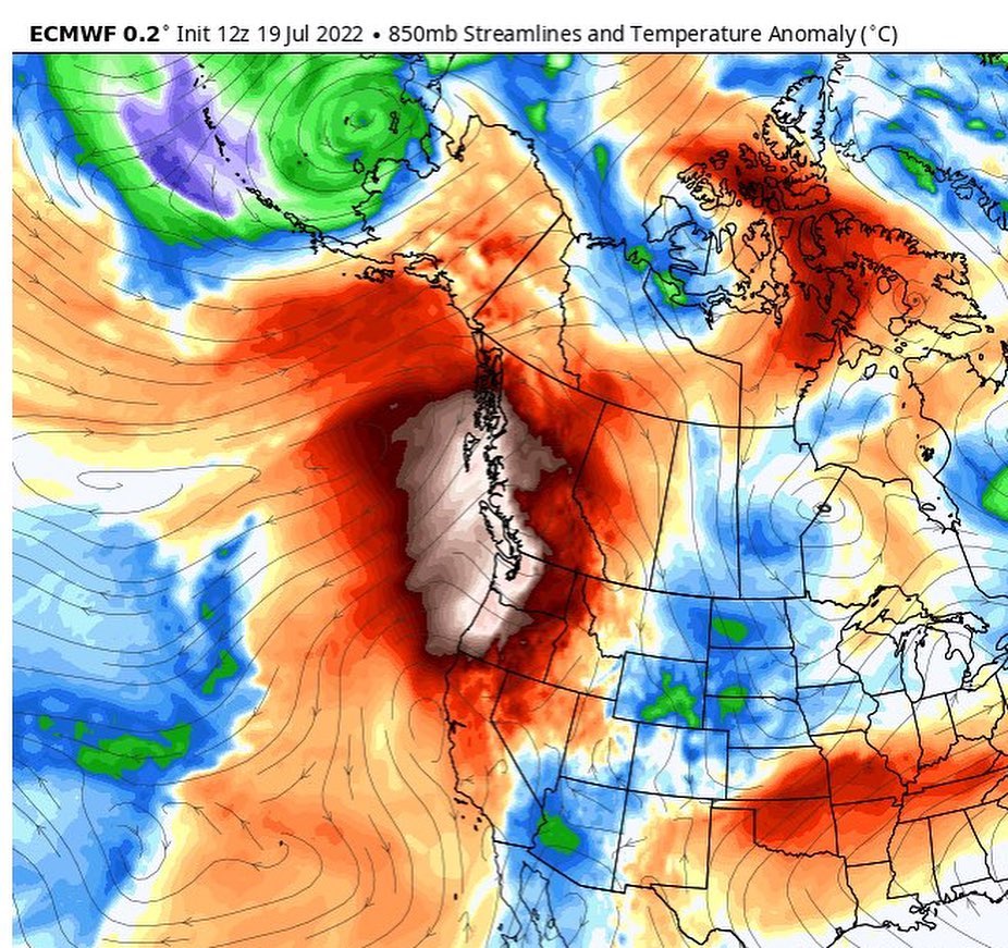
Still a bit too far out on the long range models, but there’s a general agreement among them that we are going into heatwave territory after this weekend.
The weekend, however, is looking cooler, with a pattern of early morning low clouds, burning off into sunshine. Saturday and Sunday we have a chance of staying cloudy all day.
I’m not expecting anything like the “heat dome” aka death ridge of last June, but the models are trending into the mid-90s range after the weak pacific system clears out on Sunday.
Dust off those fans, pickup an extra at the store if needed and I’ll be keeping a close eye on the upcoming model runs to see where we land with the temps going into the next workweek 🥵
#wawx #waheat #waheatwave #whidbeyweather #southwhidbey #southwhidbeyweather