Let’s chat models!
Let’s chat models! Check out the disagreement here…
Slide 1 - the ECMWF also known as “the euro” paints a potent north pac storm being engulfed by an absolute monster of a system off the west coast of AK. Model shows the lower portion of the system moving inland over western WA this weekend.
Slide 2: the GFS - tends to be a bit less accurate but can still hold its weight. What we really want is for this to agree on track and intensity with the euro. Which, for us tonight (Tuesday) - it’s not. The GFS paints the weekend storm staying off the coast with some moderate, offshore flow for us. GFS is showing the monster system - so they do agree on that!
Slide 3: The euro showing potent 45mph gusts throughout western WA for the weekend.
Slide 4: GFS says nah, keeps things mellow with light to moderate offshore breeze for us.
So - what do you think?
The “late-breaking storm” a bit of local meteorologist lore.
The “late-breaking storm” a bit of local meteorologist lore. They sort of appear from nowhere and the supercomputers seem to have a much easier time tracking storms that already exist.
These can be a problem, and since they’re undergoing strengthening into the coast they can be stronger and more potent than a storm forming way off in the gulf that we can track over hundreds of miles.
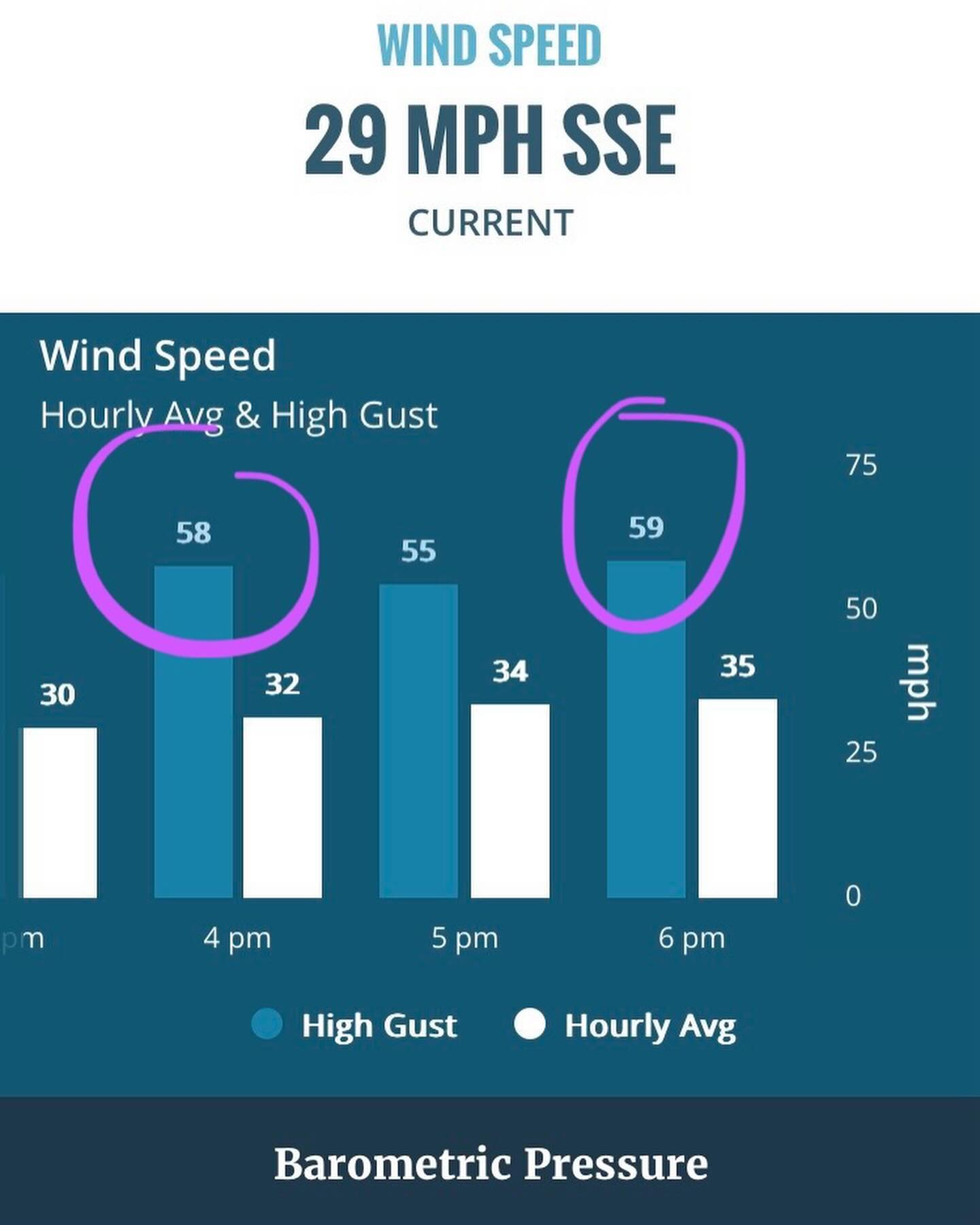
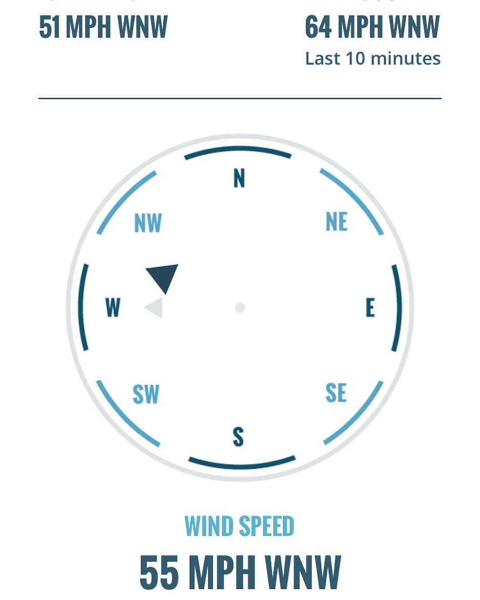
Tonight (sat) should be calm, and tomorrow (Sunday) around dawn we’ll start seeing some indications of winds beginning out of the south.
Expect that to bump up a notch sometime around noon. My guess is gusts to 45mph+ but this system moves north or south just a bit and things can change either way.
Luckily the wind is short lived - Monday, Tuesday, Wednesday are looking calm with showers and a PSCZ
After that we will need to discuss another possible wind event for Thurs/Fri or Sat. Still too far out to know for sure on that…
Thank you to everyone who reads, comments and likes these posts. It’s much appreciated 😊
The “late-breaking storm” a bit of local meteorologist lore.
The “late-breaking storm” a bit of local meteorologist lore. They sort of appear from nowhere and the supercomputers seem to have a much easier time tracking storms that already exist.
These can be a problem, and since they’re undergoing strengthening into the coast they can be stronger and more potent than a storm forming way off in the gulf that we can track over hundreds of miles and then draping over us.
Tonight (sat) should be calm, and tomorrow (Sunday) around dawn we’ll start seeing some indications of wind beginning out of the south.
Expect that to bump up a notch sometime around noon. My guess is gusts to 45mph+ but this system moves north or south just a bit and things can change either way.
Luckily the wind is short lived - Monday, Tuesday, Wednesday are looking calm with showers and a PSCZ.
After that we will need to discuss another possible wind event for Thurs/Fri or Sat. Still too far out to know for sure on that.
Thank you to everyone who reads, comments and likes these posts. It’s much appreciated 😊
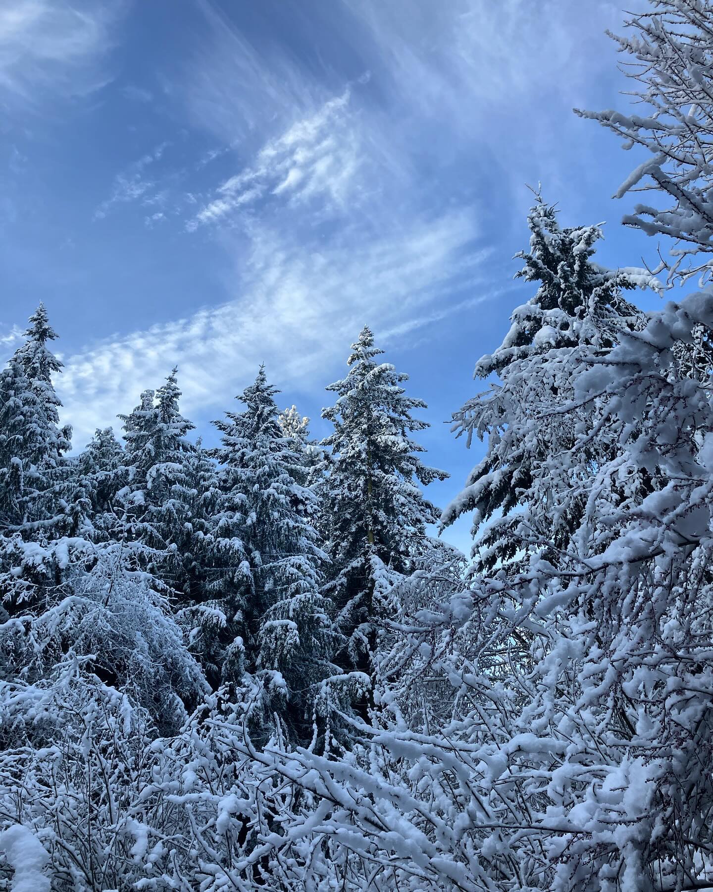
🎃 🌬️ some scenes from the day -
🎃 🌬️ some scenes from the day -
Putting it out there that we may see an increase in wind on Sunday around noon. We are seeing a late breaking wave after this event which requires a revisit tomorrow. Will update us..
Hi everyone!
Hi everyone! First significant wind event of 2024/2025 arriving Friday (tmrw) afternoon and into Sunday. I almost didn’t post since it’s out of the south and we fare pretty well in south wind under 50mph.
As always we’re are the mercy of the bridge and north whidbey in terms of electricity and it’s looking to be more windy up there, also the leaves aren’t fully off the trees so that can play into the lines down drama.
Never a bad idea to check on your friends and neighbors, top off the fuel tanks, check the oil in the generator, secure the tarps, grab a couple extras from the store.. all the things.
An atmospheric river will accompany this wind and we may see up to 2” of rain over the next 2-3 days. Officially fall with this one.
Bullseye for the AR is Vancouver Island / Tofino area where they’re expecting 12inches+ of rain. The gulf of Alaska is kicking!
I took a hiatus from this account — but leave a comment if you find these posts helpful and I’ll motivate myself to be more active again 🙌
Check out the lightning flash density from yesterday's event.
Check out the lightning flash density from yesterday’s event. Did you get a chance to check it out? #wawx
She’s coming… best guess is around 9-10pm.
She’s coming… best guess is around 9-10pm. NorCal and Oregon absolutely getting lit up this afternoon, over 1000 lightning strikes ⚡️⚡️⚡️⚡️⚡️⚡️⚡️⚡️
Saturday night!!
Saturday night!! ⚡️ ⛈️ ⚡️ hail, heavy downpours, lightning all possible — wind! Gusts to 45MPH+
ETA about 9pm 🔮🔮🔮🔮🔮🔮🔮🔮
View from space over the past 200 hours.
View from space over the past 200 hours. I wanted to note the luck we’ve been having with the air quality and smoke, as most of the west is not so lucky.
If you look closely on these slides, during the night, the fires look like freckles.
Notable fires burning in Washington, Oregon, California, Idaho, British Columbia and Utah.
Oregon and Washington remain the top priority for fire personnel.
Most of the smoke across the West is stemming from the “Park Fire” in California, which, a few days ago, was the hottest burning wildfire in recorded history.
Unfortunately our bout of rain will have minimal impact on the wildfire situation in Washington and beyond.
Back at the weather desk and we have another July anomaly 🔮 Sunday / Monday...
Back at the weather desk and we have another July anomaly 🔮 Sunday / Monday… 🌧️ 🌧️ (slide 3)
Next week the intercontinental west falls under another heatwave. To what extent we’ll be included is TBD. Will update.
July is typically the driest month and July 29th is historically the driest day.
The record rainfall amounts for Sunday July 28th: 0.54 inches (1953), and July 29th: 0.96 inches (1949)
The wild weather continues!
The wild weather continues! Update later today on what to expect 🤪
Hold on to your butts..
Hold on to your butts..